Feb. 14 (UPI) — Tropical Cyclone Zelia made landfall Friday on Australia’s west coast as a Category 4 storm with maximum sustained wind gusts at 180 mph, though minimal damage ensued.
Zelia, the fifth named storm in the Australian region this season, was a Category 5 before reaching 30 miles east of Port Hedland at 12:30 p.m. local time.
Pardoo Station recorded a peak wind gust of 75 mph and 17.16 inches of rain over a 48-hour period. Port Hedlan, which has a population of 15,000 people, is one of the world’s busiest iron ore ports, according to the bureau.
“This is a very dangerous system that will cause significant impact and is causing impacts as we speak,” Australian Bureau of Meteorology’s Matthew Collopy said in a report by News Az.
By 7 p.m., the cyclone was downgraded to a Category 3 storm with winds of 93 mph as it moved south.
Cyclone Zelia is the strongest storm to hit the Pilbara coast since Cyclone Ilsa in April 2023.
Reported damage so far has been limited to toppled trees and some minor flooding.
That includes Port Hedland International Airport, which has plans to resume service Sunday.
“Whilst we’ve got a few trees down, some localized flooding in our entry into the actual airport we have come, we are hoping, relatively unscathed,” airport CEO Hayley Vale told the Australian Broadcasting Corp.
“We are lucky we have got a relatively new terminal, we have had some water ingress into it that we can see but nothing major.”
Three weeks ago Tropical Cyclone Sean went near Western Australia as a Category 4 storm, the second storm of the season.
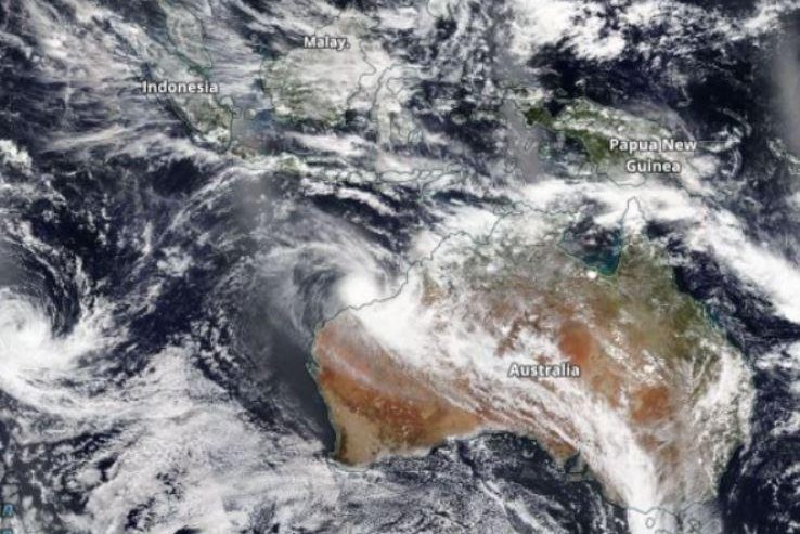
The hurricane season in Australia goes from November to April. Hurricanes are also tracked in Papua New Guinea and Indonesia.
The northwest coast of Western Australia has the most cyclones in the country, according to the Bureau of Meteorology.
Since 1961, Australia’s mainland has had 18 other storms rated Category 4 or 5 on the Saffir-Simpson Wind Scale.