THE exact date that Britain’s -13°C chill is set to end has been revealed by the Met Office today.
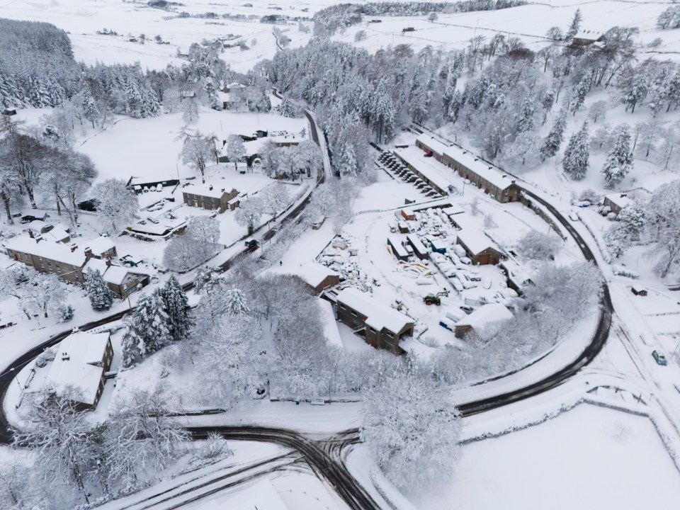
The forecaster issued fresh weather warnings as wintry conditions caused travel disruption and school closures across the country.
A warning for snow and ice is in place across most of south-west England and Wales, and parts of north-west England and the West Midlands, for between 5pm on Monday until 10am on Tuesday.
The same warning is in place for western and northern parts of Scotland for between 4pm on Monday until midday on Tuesday, and in Northern Ireland between 3pm on Monday until 11am on Tuesday.
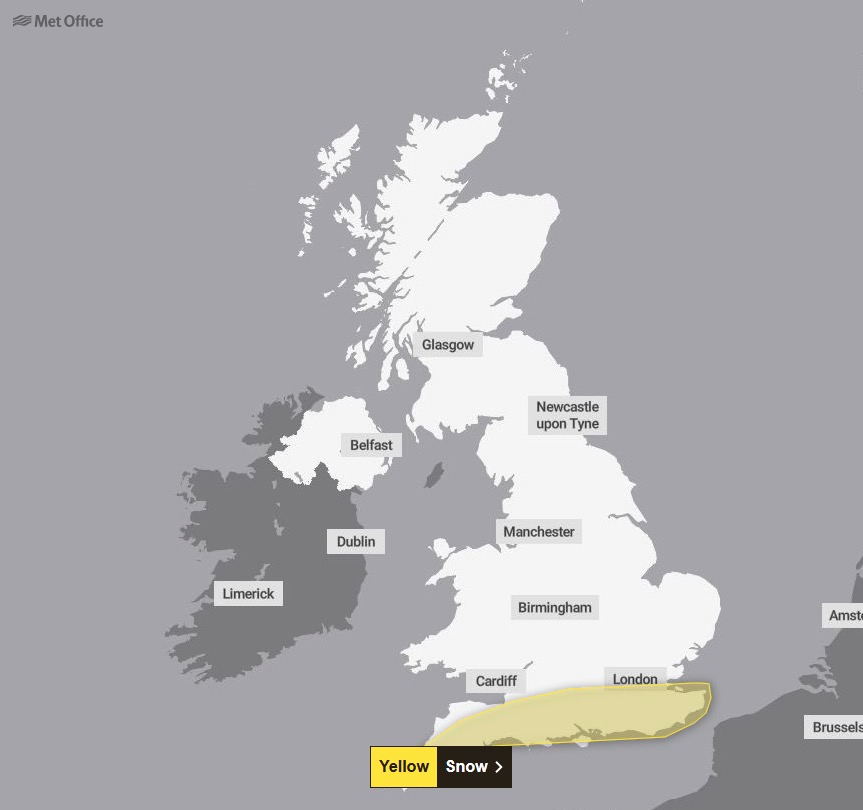
There is a separate warning for snow in southern England on Wednesday from 9am until 11.59pm.
Met Office chief meteorologist Frank Saunders said: “Hail, sleet or snow showers are expected to affect parts of Scotland and Northern Ireland, spreading to Wales and parts of north-west England this evening, before moving into part of south-west England, the Midlands and southern England during the early hours of Tuesday.
“Rain or hail is more likely towards some western coasts.
“Icy stretches which develop overnight as a result of these showers, or the recent wet conditions, could bring some disruption to travel.
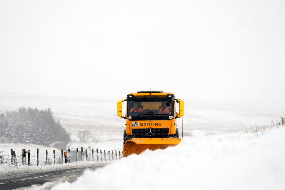
“In addition to the ice, we could see snow accumulations of a few centimetres above 200 metres, with a chance of greater than 5cm above 200 metres in Wales.
“The heaviest snow showers may also produce temporary accumulations of 0-2cm at low levels.
“It is not possible to say exactly where this snow might fall, so it’s important that people are prepared.”
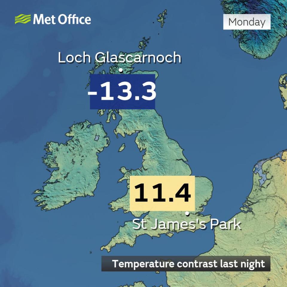
Sunday night was the UK’s coldest of the winter so far, with a temperature of -13.3°C recorded in Loch Glascarnoch in the Highlands, between Ullapool and Inverness.
It comes as many commuters suffered travel disruption on Monday morning with major roads closed and railway lines blocked.
Manchester Airport’s runways were closed early on Monday morning because of heavy snow but later reopened.
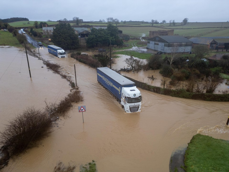
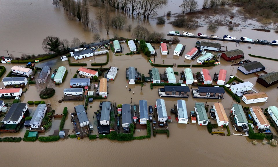
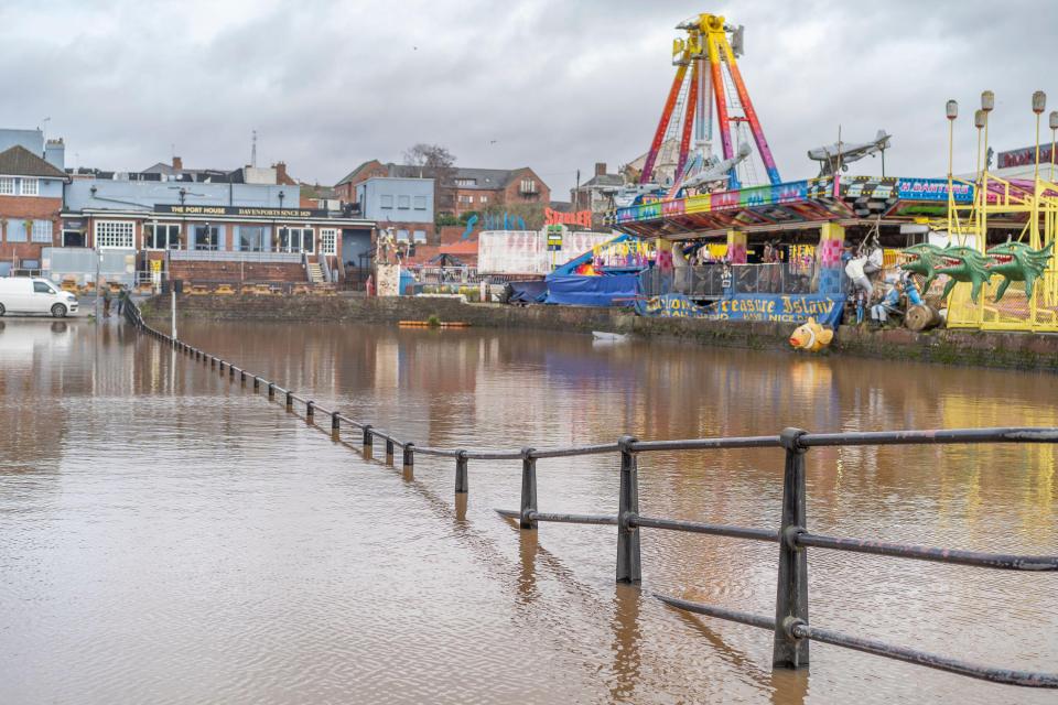
At 1pm, the Environment Agency had 165 flood warnings and 321 flood alerts active across England.
At the same time, National Resources Wales had two flood warnings and 20 flood alerts in place.
Tens of thousands of journeys on the M25 in Surrey have been delayed as the motorway is closed after a lorry crashed into the central reservation.
This is affecting many people travelling to Gatwick airport.
The closure is expected to remain in place until at least 3pm while the road is resurfaced.
Several stretches of A-roads across England are also closed because of severe weather.
Today:
Rain and snow clears eastwards, with brighter skies to follow.
Staying cold in brisk northerly winds, with wintry showers bringing hail, sleet and snow showers expected throughout the day.
Gales around some coasts.
Tonight:
Some clear spells developing but further wintry showers expected across the north and west, with a few moving across central areas.
Widespread frost expected with a rick of ice.
Tuesday:
More sunny spells with wintry showers in the north and along windward coasts.
Southern areas becoming fine and dry but winds staying strong along the coasts.
Outlook for Wednesday to Friday:
Cold with a mixture of sunny spells and wintry showers, these most frequent in the north and northwest.
A more prolonged period of snow in the south possible on Wednesday.
These include the A66 in Cumbria and the A628 Woodhead Pass in South Yorkshire/Derbyshire.
The A46 in Warwickshire is also closed because of a crash.
National Highways said “a car is reported to have aquaplaned due to flooding in the area”.
Severe weather is also causing widespread disruption on the railway network.
Flooding has forced the closure of all railway lines between Derby and both Nottingham and East Midlands Parkway.
This is affecting CrossCountry and East Midlands Railway services.
The operators are also disrupted by flooding closing all lines between Peterborough and Leicester.
Great Western Railway said its trains between Bristol Parkway and Gloucester were running at a reduced speed because of “heavy rain flooding the railway”.
TransPennine Express said severe weather was causing the same issue for its services between Barnetby and Scunthorpe in Lincolnshire.
Areas covered by weather warnings
Monday, January 6
Yellow warning – snow & ice (until midday today)
Regions and local authorities affected:
Central, Tayside & Fife
Angus
Clackmannanshire
Dundee
Falkirk
Fife
Perth and Kinross
Stirling
Grampian
Aberdeen
Aberdeenshire
Moray
Highlands & Eilean Siar
Highland
SW Scotland, Lothian Borders
Edinburgh
West Lothian
Strathclyde
North Lanarkshire
Yellow warning – snow (until midday today)
Regions and local authorities affected:
Central, Tayside & Fife
Falkirk
SW Scotland, Lothian Borders
Dumfries and Galloway
East Lothian
Edinburgh
Midlothian Council
Scottish Borders
West Lothian
Strathclyde
North Lanarkshire
South Lanarkshire
Yellow warning – snow & ice (until midday today)
Regions and local authorities affected:
East Midlands
Derbyshire
Nottinghamshire
North East England
Darlington
Durham
Gateshead
Hartlepool
Newcastle upon Tyne
Northumberland
Redcar and Cleveland
Stockton-on-Tees
North West England
Blackburn with Darwen
Blackpool
Cheshire East
Cheshire West and Chester
Cumbria
Greater Manchester
Halton
Lancashire
Merseyside
Warrington
Wales
Conwy
Denbighshire
Flintshire
Gwynedd
Powys
Wrexham
West Midlands
Shropshire
Staffordshire
Stoke-on-Trent
Telford and Wrekin
West Midlands Conurbation
Yorkshire & Humber
East Riding of Yorkshire
North Lincolnshire
North Yorkshire
South Yorkshire
West Yorkshire
Yellow warning – snow & ice (5pm today to 10am tomorrow)
Regions and local authorities affected:
London & South East England
Bracknell Forest
Buckinghamshire
Hampshire
Oxfordshire
Reading
Southampton
Surrey
West Berkshire
Windsor and Maidenhead
Wokingham
North West England
Blackburn with Darwen
Cheshire East
Cheshire West and Chester
Greater Manchester
Halton
Lancashire
Merseyside
Warrington
South West England
Bath and North East Somerset
Bournemouth Christchurch and Poole
Cornwall
Devon
Dorset
Gloucestershire
North Somerset
Plymouth
Somerset
South Gloucestershire
Swindon
Torbay
Wiltshire
Wales
Blaenau Gwent
Bridgend
Caerphilly
Cardiff
Carmarthenshire
Ceredigion
Conwy
Denbighshire
Flintshire
Gwynedd
Merthyr Tydfil
Monmouthshire
Neath Port Talbot
Newport
Pembrokeshire
Powys
Rhondda Cynon Taf
Swansea
Torfaen
Vale of Glamorgan
Wrexham
West Midlands
Herefordshire
Shropshire
Staffordshire
Stoke-on-Trent
Telford and Wrekin
Warwickshire
West Midlands Conurbation
Worcestershire
Tuesday, January 7
Yellow warning – snow & ice (5pm today until 10am tomorrow)
Regions and local authorities affected:
London & South East England
Bracknell Forest
Buckinghamshire
Hampshire
Oxfordshire
Reading
Southampton
Surrey
West Berkshire
Windsor and Maidenhead
Wokingham
North West England
Blackburn with Darwen
Cheshire East
Cheshire West and Chester
Greater Manchester
Halton
Lancashire
Merseyside
Warrington
South West England
Bath and North East Somerset
Bournemouth Christchurch and Poole
Cornwall
Devon
Dorset
Gloucestershire
North Somerset
Plymouth
Somerset
South Gloucestershire
Swindon
Torbay
Wiltshire
Wales
Blaenau Gwent
Bridgend
Caerphilly
Cardiff
Carmarthenshire
Ceredigion
Conwy
Denbighshire
Flintshire
Gwynedd
Merthyr Tydfil
Monmouthshire
Neath Port Talbot
Newport
Pembrokeshire
Powys
Rhondda Cynon Taf
Swansea
Torfaen
Vale of Glamorgan
Wrexham
West Midlands
Herefordshire
Shropshire
Staffordshire
Stoke-on-Trent
Telford and Wrekin
Warwickshire
West Midlands Conurbation
Worcestershire
Flooding means Transport for Wales services between Manchester and North Wales are only able to operate between Warrington Bank Quay and Manchester.
Manchester Airport said at 7.15am that its two runways had reopened after reporting at 6.30am that they were closed because of “heavy snow”.
Three departures for Monday have been cancelled and a number of other flights were delayed.
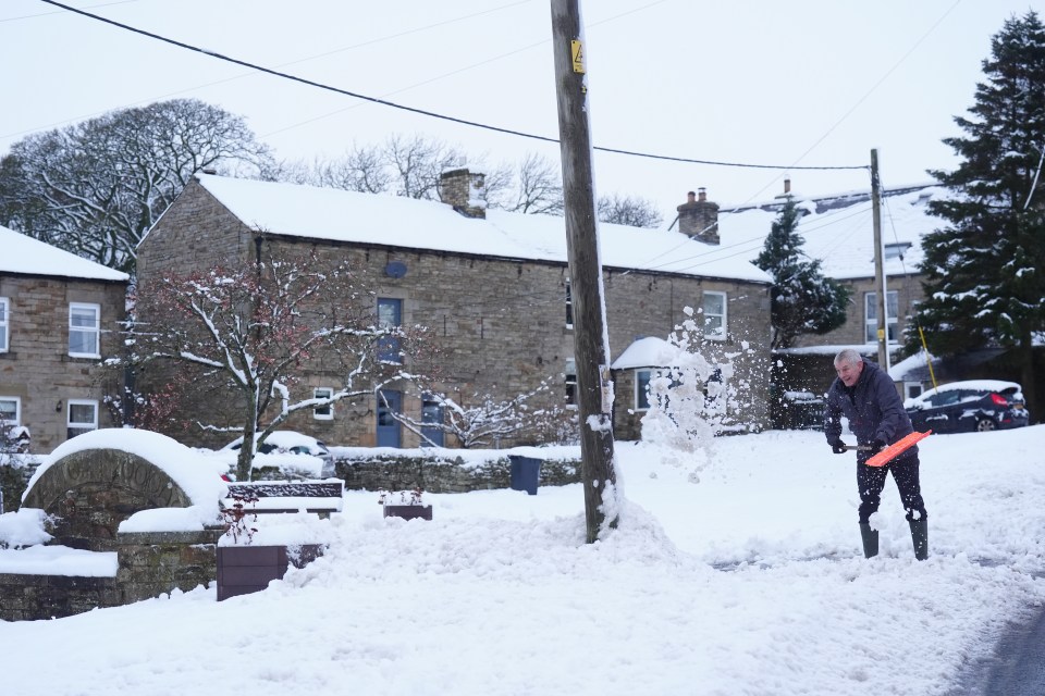
Hundreds of schools were closed on Monday in areas including Lancashire, Yorkshire and north-east Scotland.
