BRITS are bracing for snow to fall in just days – as they are warned of a bone chilling -2C New Year’s Eve ahead.
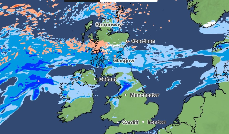
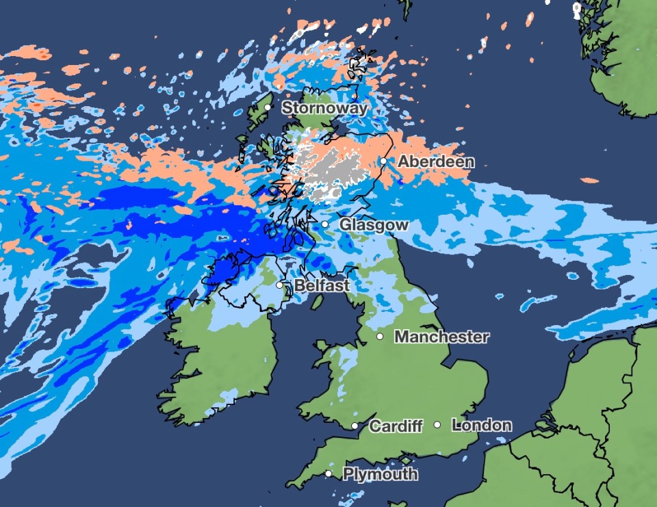
Met Office maps revealed the exact moment snow is set to settle over large parts of the UK.
The first snowflakes are set to hit northern Scotland on Monday December 30 at 6pm.
It will continue to get heavier as the evening progresses, with hail also sweeping in the batter the country.
By midnight there will be up to four millimeters per hour falling across northern Scotland and the Scottish Highlands.
There are hail storms and torrential rain predicted in surrounding areas, reaching their peak at around 3am.
Meanwhile the Boxing Day forecast shows a misty morning for Brits in the south of England and Wales.
Scotland and Northern Ireland can expect to see patches of heavy rain, particularly in Glasgow, Edinburgh.
The north of England may see some sunny spells by the afternoon.
Much of Britain will experience seasonal average temperatures, with higher figures further north.
Scotland and Northern Ireland are forecast to hover at around 10C throughout the day.
The afternoon should also bring highs of 10C to south west coast of England in areas such as Plymouth.
Elsewhere, much of England and Wales will remain at around 8C or 9C throughout the day, while the Midlands are predicted lows of 6C.
However figures are set to plummet next week as revellers look forward to New Year’s Eve celebrations.
Temperatures are expected to reach lows of -2C in northern Scotland, with much of the country set to remain just above freezing for festivities.
Met Office meteorologists forecast the north of England and Midlands staying at around 4C.
Met Office meteorologist Tom Morgan said: “Not a lot changes through the rest of this week and indeed this weekend, but as we move towards the New Year, we could see a change to cooler conditions and wetter conditions more widely.
“There could be some heavy rain at times and there is an increasing chance of some snow – but it’s too early to say where that snow is going to fall.”
FIVE DAY WEATHER FORECAST
The Met Office:
Today:
Rain will affect central and southern Scotland and parts of Northern Ireland on Boxing Day. Mostly dry and mild, though rather cloudy, further south. Brighter, but colder, across northern Scotland.
Tonight:
Remaining cloudy for most overnight with outbreaks of rain and drizzle across parts of central and northern Scotland, with clearer spells in the far north of Scotland. Mild.
Friday:
Another mild and mostly cloudy day on Friday with patchy rain across parts of Scotland and northern Ireland. Brighter and chilly in the far northwest with isolated showers.
Outlook for Saturday to Monday:
Rain in the northwest clearing southeastwards through Saturday. Then brighter, but colder, with blustery showers, and later rain and hill snow in north on Sunday and Monday.
Moving south, temperatures only climb a few degrees, with highs of 7C on the coast as the bells bring us into 2025.
It comes after Brits woke up to a “green Christmas” and exceptionally warm weather yesterday.
Forecasters said the “exceptionally mild” temperatures seen on Christmas Eve will likely continue until closer to the new year.
Mr Morgan said this year will be a “green Christmas” as no snow or frost is expected anywhere in the country.
He added: “So great news if you do have travel plans over the next few days, no weather warnings are expected, no disruptive weather – but, as I say, not great news if you want a festive feel and certainly no snow or frost on the way.
“Christmas Eve has been very mild – we haven’t broken any records, but we did see a high temperature today of 14.8C in Aberdeen, which is exceptionally mild for Christmas Eve.
“It’s going to stay very similar through the Christmas period, so Christmas Day will dawn cloudy and very mild once again.”
LONG RANGE FORECAST
The Met Office outlook from Monday December 30 to Wednesday January 8;
“Fronts or low-pressure areas are increasingly likely to move south/east across much of the country, bringing an increased threat of heavy rain and perhaps strong winds.
“As colder air from the north progresses southwards, the risk of sleet and snow increases, especially in northern areas, but this will depend each day on where the thermal boundary lies.
“Temperatures will start around average but will become a little below average for most, especially in the north, though milder interludes are still possible in the south.
“While there is moderate to high confidence in this trend, confidence is low for the exact positioning of any systems, which will be crucial in determining which areas see rain or snow.”


