BRITS have been urged to brace for Storm Darragh as it hit today and amber “danger to life” warnings are issued.
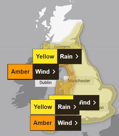
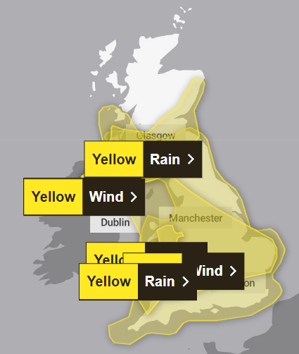
The Met Office has placed large areas of the UK under six yellow weather alerts today and two amber warnings are in place tomorrow.
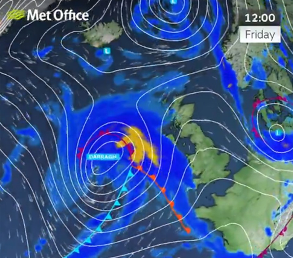
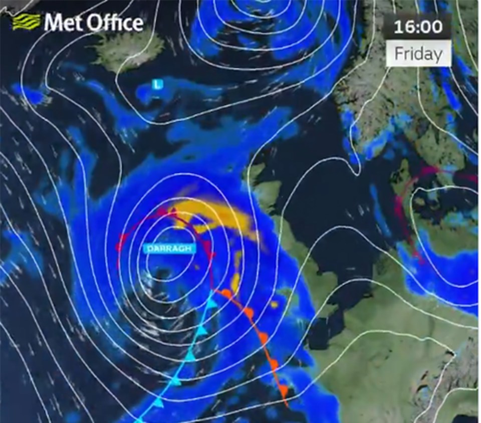
Storm Darragh – the fourth named storm of the season – will hit the UK this afternoon and through the weekend, adding to the weeks of disruption caused by floods, icy conditions and fog.
Those in southern Scotland are expected to be affected by a yellow weather warning for rain today.
This comes into force at 3pm and lasts until midday on Saturday.
A yellow weather warning for rain and wind also covers Northern Ireland from 3pm until 6am Saturday.
The Met Office then issued yellow weather alerts for wind over much of England and Wales.
This larger warning also covers more areas of northern England, Wales, the Midlands, East Anglia and Northern Ireland, plus parts of the South West and Yorkshire.
The other warning begins at the same time but ends at 6am on Sunday and covers the whole of the south coast.
A yellow weather notice for rain over the same areas is in force from 3pm until midday on Saturday.
There are two amber weather warnings on Saturday that affect Northern Ireland, Wales, southern Scotland, the west of England and the south west coast.
Both notices are in place from 3am on Saturday to 9pm before being downgraded to yellow weather warnings on Sunday until 6am.
Met Office meteorologist Dan Stroud told the PA News Agency the weather service is “a bit concerned” about the risk of flooding in parts of Wales and Northern Ireland where there is “heightened sensitivity” due to recent heavy rainfall.
Mr Stroud added: “The wind particularly is set to be reasonably disruptive and potentially quite damaging.
“We are rather concerned about the strength of the winds affecting the Irish sea coasts and this is likely to have impacts on Irish ferry services.
“Trees could come down onto roads and people need to be aware of this and allow extra time for travel, especially in rural spots.”
The Met Office forecast reads: “Injuries and danger to life is likely from large waves and beach material being thrown onto coastal roads, sea fronts and properties.”
“Flying debris is likely and could lead to Injuries or danger to life
Some roads and bridges likely to close, with falling trees an additional hazard,” the warning added.
There is also a “good chance” of power cuts and limited mobile phone coverage.
Some damage to buildings can also be expected in high winds such as roof tiles being ripped off.
Travel chaos including longer journey times, delays and cancellations on rail, air and ferry services are predicted.
National Highways issued a severe weather alert for Saturday and has warned motorists in the South West and North West to prepare for gale force winds
It said routes likely to be affected by the strongest winds include the M5 in northern Somerset, the A30 in Cornwall and the M6 in Cheshire.
Severe winds are already affecting travel in parts of the country with the M48 Severn Bridge in Gloucestershire was being closed on Thursday night because of gusty weather.
Aidan McGivern said in a Met Office YouTube forecast: “In the west the weather deteriorates ahead of Strom Darragh, that’s going to bring in a spell of heavy rain.
“Once again Northern Ireland, much of Scotland, England and Wales seeing wet weather arrive by the end of Friday- and that will be falling as snow above 300meters for Scotland.
“Further spells of rain push through Northern Ireland western England, Wales and southern Scotland on Saturday. A very blustery and wet day.
“The rain will accumulate to 60 or more millimeters across parts of Northern Ireland, southern Scotland, western England and that could cause disruption.
“But the main cause for concern is the wind. Wind gusts are expected to widely reach across southern Scotland, Northern Ireland, much of England and Wales 50 to 60mph.
“For the windiest parts there’s risk of 70mph inland and 80mph or more for some exposed coastal parts.
“This could cause significant disruption, power outages, travel disruption, damage to buildings and dangerous conditions around coasts.”
The Environment Agency also said it is carefully monitoring the progress of the storm ahead of the weekend.
Katharine Smith, Flood Duty Manager, said: “Environment Agency teams are out on the ground and will support local authorities in responding to surface water flooding.
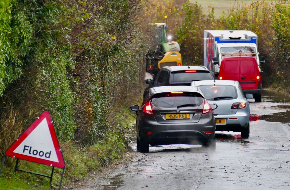
“We urge people not to drive though flood water – it is often deeper than it looks and just 30cm of flowing water is enough to float your car.”
At present there are 19 flood warnings were flooding is expected across England, 11 alerts in Scotland, and five in Wales.
Five day weather forecast
Friday
A dry bright start with a few showers continuing in the northwest.
Wet and increasingly windy weather arriving later from the west later as Storm Darragh arrives by the evening.
Outlook for Saturday to Monday
Wet and very windy on Saturday, with severe gales possible in places with Storm Darragh.
Some snow in the north. Gradually becoming more settled during Sunday and Monday, winds easing.
