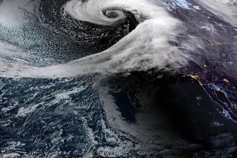
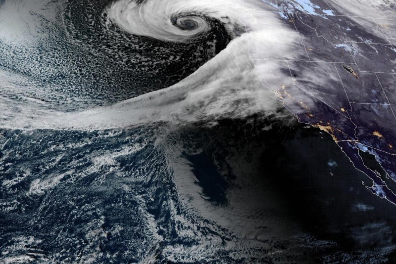
A once-in-a-decade bomb cyclone forms off the West Coast of the United States on Tuesday and is expected to hit Washington, Oregon and northern California, bringing powerful winds with gusts up to 70 mph and as much as 15 inches of rain with heavy snow in the mountains through Wednesday. Photo courtesy of NOAA
Nov. 19 (UPI) — A powerful bomb cyclone is taking aim at the Pacific Northwest and northern California with hurricane force winds forecast to gust up to 70 mph with as much as 15 inches of rain and heavy snow in the mountains.
The National Weather Service said the once-in-a-decade bomb cyclone was forecast to hit Washington, Oregon and northern California on Tuesday afternoon through Wednesday morning.
“Travel could be very difficult to impossible,” the National Weather Service warned. “Strong winds could cause extensive damage to trees and power lines.”
“The strong low pressure system currently impacting the West Coast has a very impressive look to it on recent satellite imagery,” according to the National Weather Service. “Strong winds and blizzard conditions remain on track to impact western Washington this afternoon into early tomorrow morning.”
A bomb cyclone — or bombogenesis — is a strong storm system, which in this case is an atmospheric river on the West Coast, that feeds on a drop in air pressure. The pressure at the center of the storm is expected to drop 24 millibars in 24 hours.
“Significant winds alongside lowland rain and mountain snow are on track to move into western Washington this afternoon and evening,” the National Weather Service in Seattle warned Tuesday in a post on X, which showed the bomb cyclone forming off the West Coast.
“This one was predicted to deepen, more like 60 millibars in 24 hours, which is obscenely fast and very unusual,” said Marty Ralph, the director of the Center for Western Weather and Water Extremes. “It’s exceptionally intense.”
Gusts of up to 90 mph are forecast for the 14,411-foot summit of Mount Rainier in Washington state. Wind gusts along the coast could reach 85 mph, with waves hitting 34 feet.
In northern California and southern Oregon, rainfall could surpass 1 foot, with more than 3 feet of snow forecast for the mountains.
Crews throughout the Pacific Northwest are preparing for downed trees and power outages. Residents in Washington state are being warned to avoid the mountain passes and to expect rough waters, as well as ferry service disruptions on Puget Sound.
“Prepare for potential delays with today’s forecast, Washington State Ferries warned Tuesday afternoon in a post on X. ” Dramamine may be helpful, as we expect bumpy rides throughout the region.”

