In early October, I walked the 27.4 miles of Washington Boulevard in one day. It began in Whittier near a chaotic intersection known colloquially as Five Points and ended on the coast in Venice. Why would I do that? Everyone from the cashier at my Trader Joe’s to my mother wanted to know.
I hoped this trek would show me an authentic slice of life in L.A. The greater narrative of the city often centers on one binary: that we contain the wealthiest and the poorest of America. We do. And traveling the city by car often seems to highlight these disparities, coasting through tent cities to arrive at high-end art galleries or restaurants. But living and reporting in the city has taught me there’s much more nuance to it. The culture and life of L.A., its beating pulse, gets passed over as we follow the turn-by-turn directions on our GPS maps. I thought walking Washington Boulevard would allow me a glimpse of that. I would start in a working class and middle-income area in Whittier and the boulevard would take me all the way through to our city’s wealthier enclaves by the ocean.
This, I learned as I began to research my path, was all by design. In 1923, the Greater Washington Boulevard Association announced its fundraising campaign to improve the existing, poorly maintained road from Whittier to the sea to improve L.A. traffic and increase adjacent property values.
“Nature has endowed Los Angeles with the Baldwin Hills on one side and the Hollywood Mountains on the other,” boasted association president Harry H. Culver, founder of Culver City. “In between there is a great pathway which might be called the path of destiny. And in the center of the path is Washington Boulevard.”
101 years later, does it live up to the hype? I was going to find out. Below is a diary of my journey, organized by time of day.

Oct. 10, 7:15 a.m.
My wife drops me off at the start of Washington Boulevard in Whittier, next to a large metal truss bridge that’s part of the 4.5-mile Whittier Greenway Trail, a commuter and recreation path. Carrying a backpack of water, first aid supplies and (too few) snacks, I head off in a neon-lime technical training hoodie with UPF 20+ sun protection and some old stretchy hiking pants.
I figure out where to start. Washington Boulevard begins near State Route 72, at an intersection where five streets meet: Washington Boulevard, Whittier Boulevard, Pickering Avenue, La Cuarta Street and Santa Fe Springs Road. I did not expect to need to consult my GPS for a marathon walk down one street, but here I am among morning commuters, looking like a lost tourist.
7:38 a.m.
Walking allows me time to observe small details I could only notice from the sidewalk. Like the variety of pedestrian crosswalk buttons across an area. (They come as small silver cylinders and large round black buttons.) I notice the differences in each city’s street signs. Montebello’s has the decorative flair of a rose. The city was once replete fields of 150 varieties of roses, and sales of the flower was one of the city’s largest businesses until industrial development began there in the early 1900s.
I am pleased by just how much plant life I spot, yellow lantana, a yellow daylily and a hulking pine tree. I begin counting every dog I see and every honk I hear.
I document Nos. 3 through 7 as I navigate busy Norwalk Boulevard near the border of Sante Fe Springs and Whittier. Drivers wait in turn lanes through multiple light changes, expressing anxiety in short loud honks. In my voice note to myself, I say, “I hope I don’t get hit by a car,” and mean it.
8:11 a.m.
I navigate the crosswalks of the 605 Freeway on- and off-ramps. They feel more like an afterthought than a path for humans. Drivers pay them little mind as they rush onto what’s otherwise known as the San Gabriel River Freeway. I pause to appreciate its eponymous waterway one-tenth of a mile from the freeway, a river I frequently hike along. Below me, cyclists and runners traverse the well-maintained river trail.
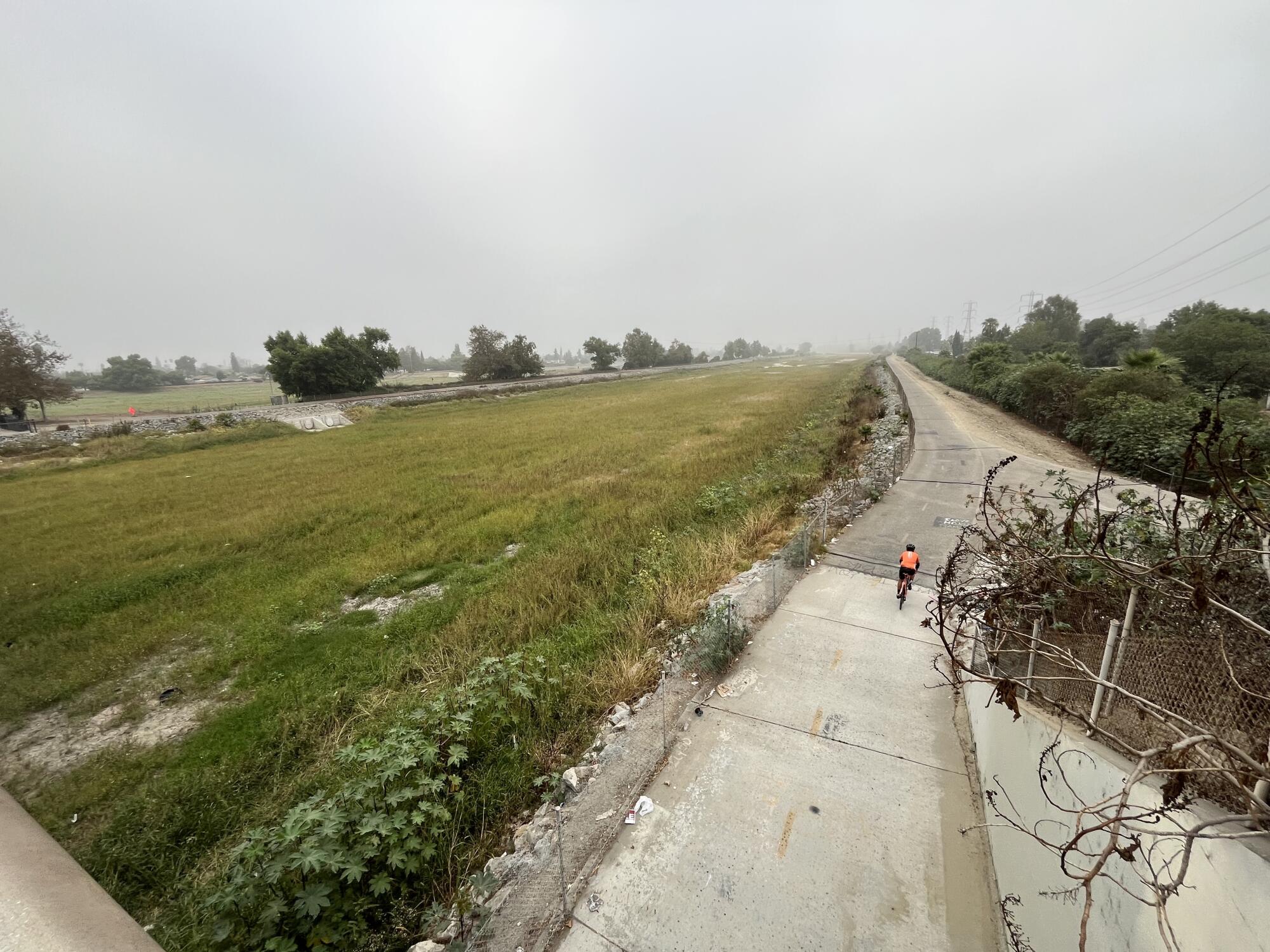
A cyclist rides along the San Gabriel River trail near Pico Rivera.
(Jaclyn Cosgrove / Los Angeles Times)
Minutes later I’m greeted by a sign that reads “If you lived in Pico Rivera, you would be home now!” I trek past tall pepper trees, and the red barn-like Pico Rivera Historical Museum, the classic Dal Rae restaurant where they still make bananas fosters tableside. Known as Sejat by the Tongva people, the community was largely agricultural, with walnuts as its primary crop, until housing and businesses sprouted up after World War II.
Near the border of Pico Rivera and Montebello, I visit the historical marker for the Battle of the Rio San Gabriel, which ended Jan. 8, 1847. It was an important victory for the Americans in the U.S.-Mexican War. Today, two cannons point out toward the Rio Hondo, a tributary of the L.A. River where the battle took place.
I try my best to enjoy these Gateway Cities, but am alarmed by the volume of the surrounding traffic. Washington Boulevard is a truck route in multiple cities, which means larger trucks can legally traverse it. And they pass near several residential neighborhoods. I think about how the whoosh and exhaust of the vehicles can meddle with the haven of a front porch, or a yard. And I think about what they’re carrying: probably merchandise that’ll be bought and sold on Amazon and other massive retailers. Maybe even the same items as the hundreds of local small businesses I’ve already passed.
9:41 a.m.
I arrive in the aptly named Commerce, where the sidewalks and any sign of pedestrian life quickly disappear. This is the place of industry. Starting in the late 1880s, large rail companies built their main lines through the area, which brought factories. The city was named to match its purpose. I pass warehouses selling freezers, wholesale party supplies and furniture.
10:27 a.m.
Things in Commerce start to perk up after I walk under the 5 Freeway. I spot a small black-and-white house — the first housing I’ve spotted here — that appears to have been recently flipped. It features Neutraface, sometimes called “gentrification font.” Then more housing, a hardware store and some restaurants. There’s even a vegan popsicle shop named Vegano by Stick Station, where I reward myself for hitting my eighth mile with a frozen fruit treat.
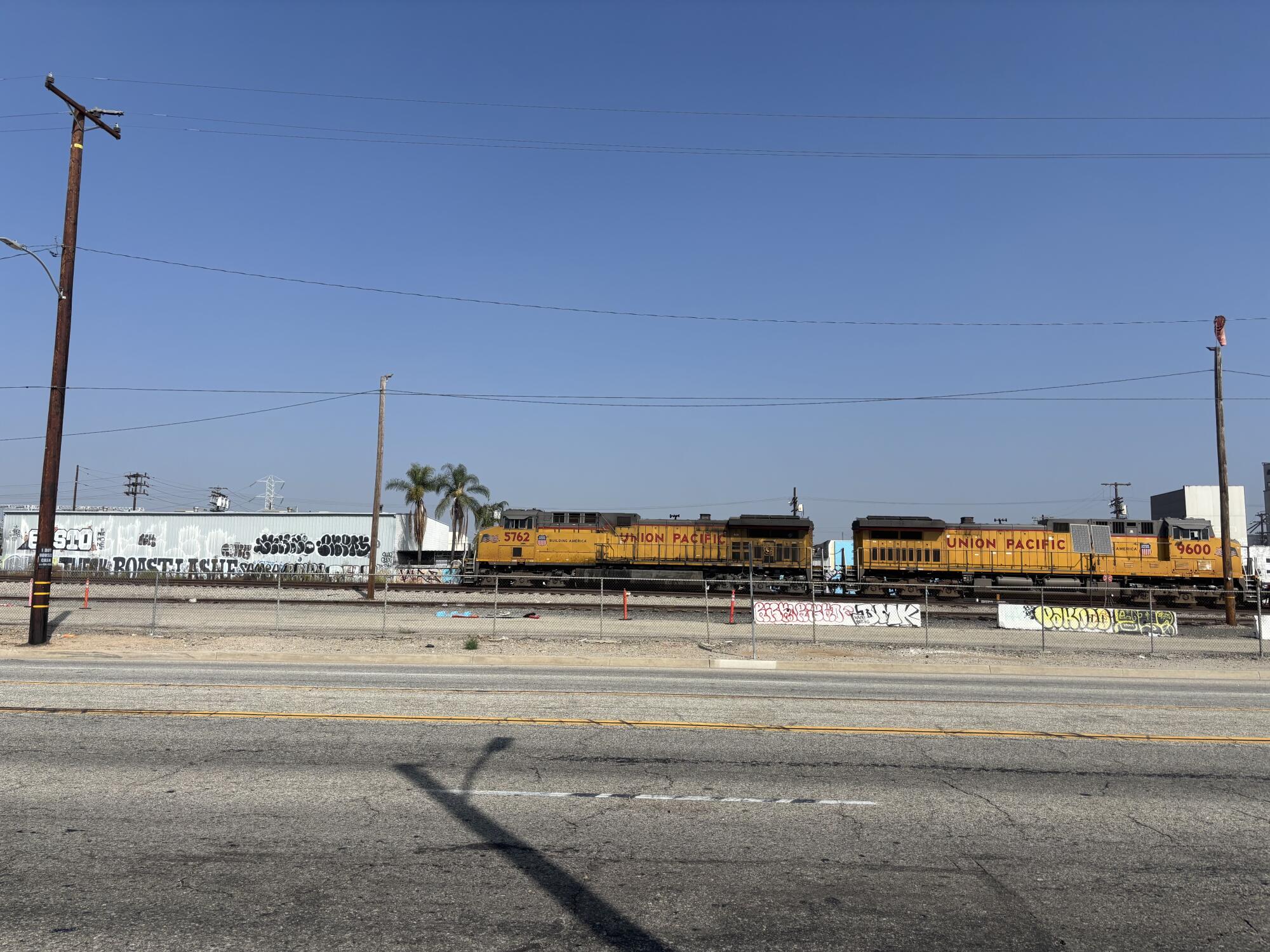
Trains at a rail year in Vernon.
But after I walk just under two miles between the 5 and the 710 freeways, the view turns to mostly concrete and sheet metal amid the sweeping rail yard, including BNSF Railway’s Hobart yard, which is 243 acres. Freight leaves here to more than 1,000 destination cities.
The air is thick with smog from the heavy truck traffic. There are few trees and a lot of invasive fountain grass growing through cracks in the concrete.
11:44 a.m.
11 miles in, I consider quitting. I’m in either Commerce or Vernon, and I’m choking on the air. There is concrete as far as the eye can see. The trucks are deafening.
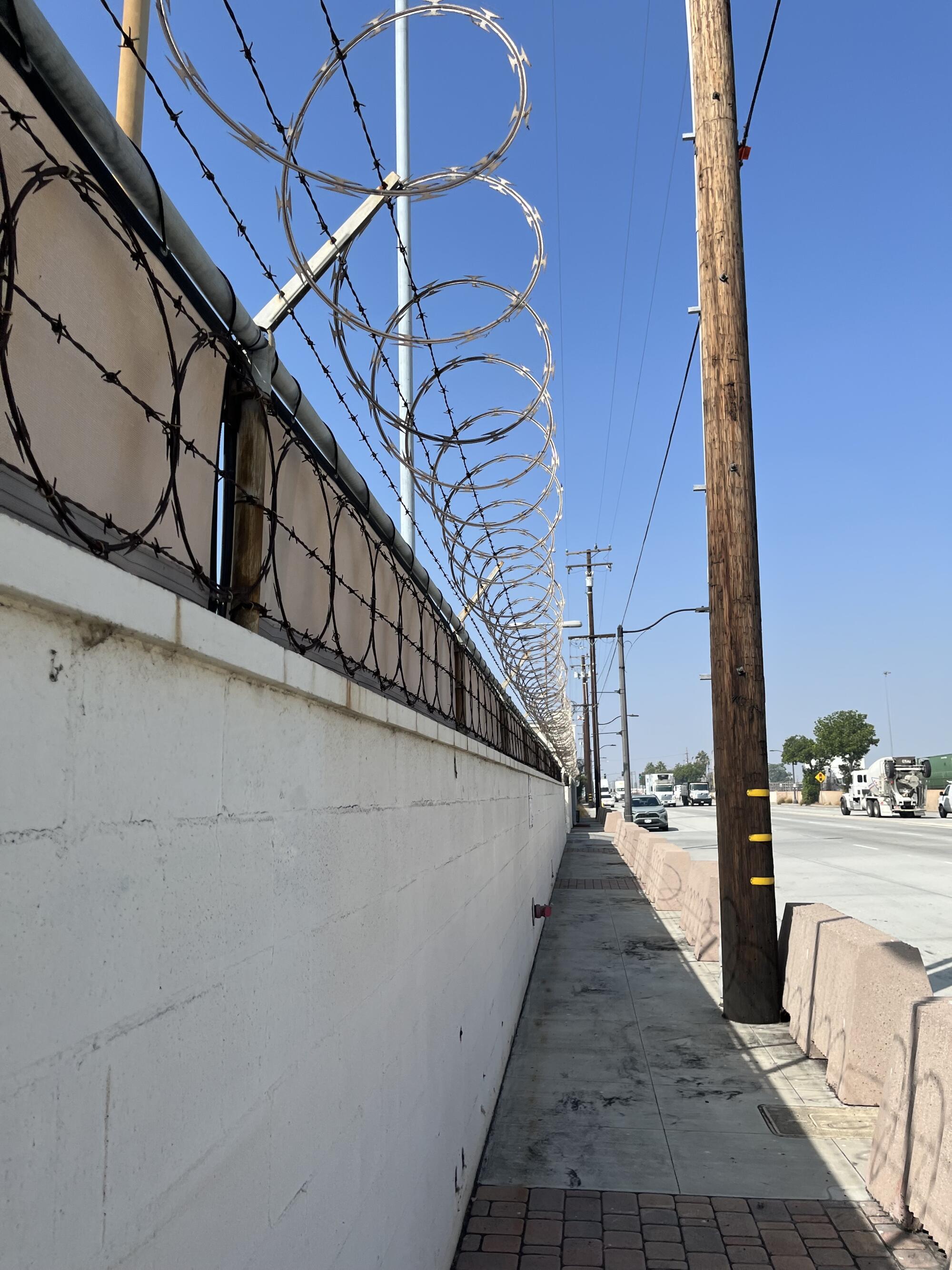
Razor wire along a fence in an industrial area near Commerce.
(Jaclyn Cosgrove / Los Angeles Times)
I want to sit down to rest, but there’s a black ashy dirt that feels like it deserves its own California Prop 65 warning. Aside from one confused soul, there is not a human being around me.
I am running low on hope. Then I look up. Above me is a red-tailed hawk. Since my brother died in 2018, he has sent me these striking birds in difficult moments. There, in the direct sun, surrounded by fences and razor wire, I decide to continue. I know there is far more to L.A. than this industrial hellscape and I intend to see it, for myself, by foot.
After trudging for a bit longer, I spot a sex toy shop, Honey Donuts & Chinese Food and a beautiful 7-Eleven in succession. A jolt of hope surges through me. I know Los Angeles is near.
12:20 p.m.
I arrive at the L.A. River. and stop to take in both the flowing water and life around it, and the bridge’s historic concrete pylons that feature different types of laborers. Dozens of pigeons roost on concrete above the mossy water.
One mile later, I stop for food at 365 Thai Kitchen, just outside the Fashion District, where I enjoy fried tofu, yellow curry and rice. I am near reverent to the workers and elated to have a quiet meal.
But, near my table, two male fashion photographers loudly discuss how challenging it is to be a man. One of them bemoans a model with thousands more Instagram followers than him.
“All she does is show her body, and here I’m doing podcasts every day,” he says.
“Girls will always get more attention than us,” his friend replies. “It’s so much easier. They don’t even have to be pretty.”
I choke on my rice laughing, and they both look up. I felt the universe laughing at me. Which did I prefer more: A brutal concrete landscape or toxic masculinity over delicious Thai food?
2:45 p.m.
I finish lunch and meet my friend Lindsay, who works in historic preservation, outside the restaurant. Though physically sated, I am still starved for human contact and am happy she’s here.
About a mile later, we pass West Adams Preparatory High School, where two students are lowering the flag. One is strictly following the color guard ceremony and lambasting the other for fumbling the folding of Old Glory.
3:54 p.m.
We pass Angelus Rosedale Cemetery. Founded in 1884, it was the first cemetery in L.A. to allow people of color to be buried there, including jazz virtuoso Eric Dolphy and actress Anna May Wong. After being denied entry into Hollywood Forever, which at the time had a “whites only” policy, actress Hattie McDaniel was laid to rest here instead.
Throughout the walk, but especially in L.A., I notice pointy, menacing metal fences around businesses and nonprofits, both large and small. Sometimes they even appeared around trees. And, there were cameras everywhere. I thought I’d have the chance to engage with more local businesses, instead I feel like I’m being surveilled by them. I begin to wave at each camera I see.
Lindsay and I hit 17 miles in Harvard Heights, and walking alongside a food cart vendor, she buys elote on a stick. She is one of many food vendors we pass by, selling pupusas, tacos and more. We could easily eat our way through Washington Boulevard. We smell delicious food from numerous local restaurants too, many of which we’d previously driven by without a second glance. We make mental (and iPhone) notes about which we’d like to return to, like La Pupusa Urban Eatery and Lucy’s Restaurant & Bakery in Pico-Union.
In Wellington Square, I notice a Kingdom Hall of Jehovah’s Witnesses across the street from the Los Angeles Smyrna Seventh-day Adventist Church, two Christian denominations with significantly different doctrinal beliefs. I’m pleasantly reminded that L.A. is one of the most religiously diverse cities in the world, and find myself hoping that this particular coexistence is a peaceful one.
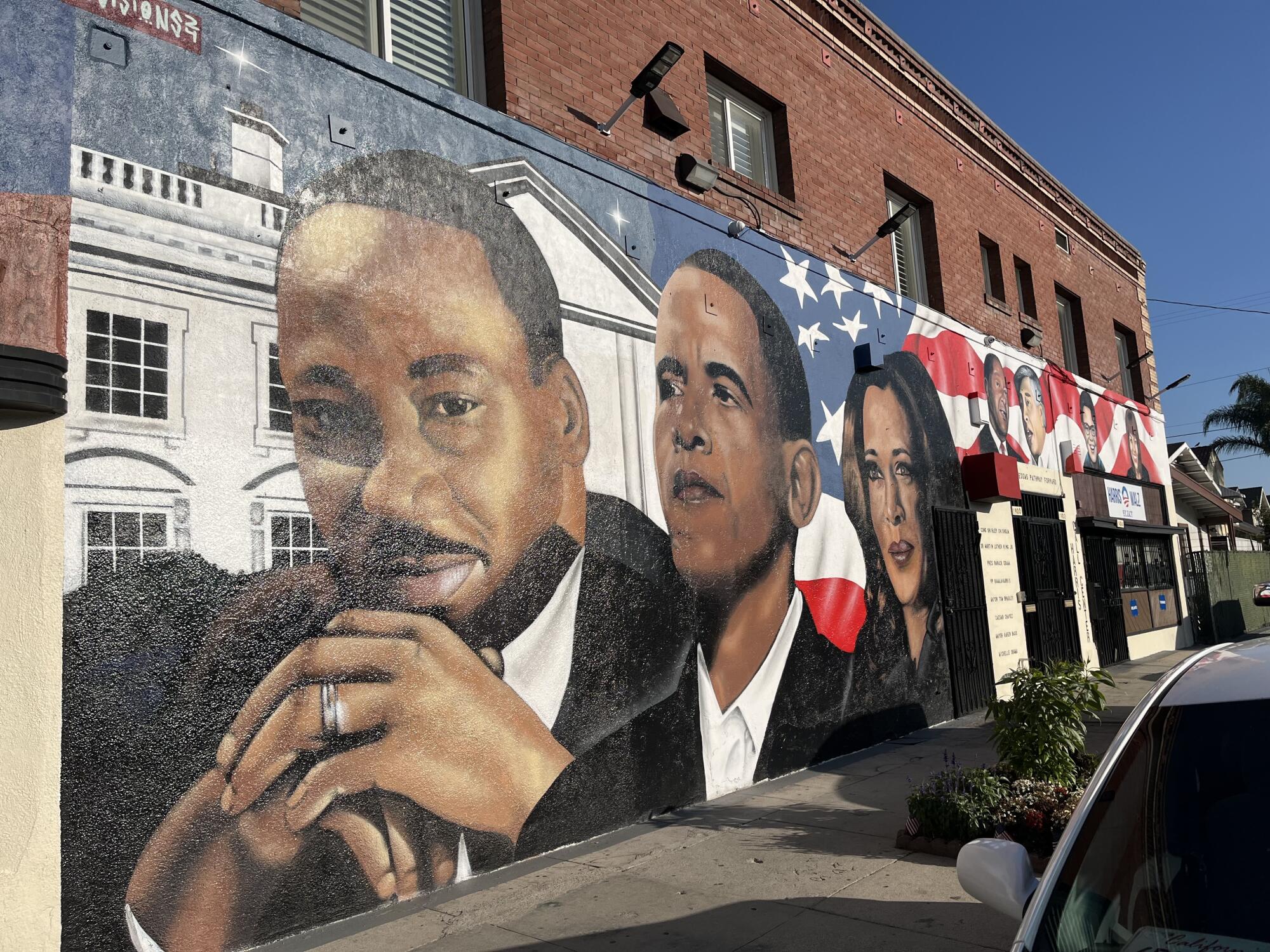
The Freedom’s Pathway Forward mural at the 3400 block of West Washington Boulevard in Los Angeles.
(Jaclyn Cosgrove / Los Angeles Times)
By now we’ve witnessed a rainbow of public art. Spray-painted hearts, but shockingly not a single male genital. Bouncy, colorful tags in places I didn’t know a human could reach. And gigantic murals depicting a spotted sloth, a baby devil, soccer players, an anthropomorphic barber pole, pink octopus tentacles, Jesus, a muscle car with the license plate “TRAUMA,” the rapper Ice Cube, a woman at her laptop surrounded by monarch butterflies and a dog.
4:30 p.m.
We hit 18 miles while taking in the architecture of Harvard and Western Heights, where racist restrictive covenants once barred people of color from living. Residents fought this, and by the 1980s, Western Heights became one of the most diverse neighborhoods in the U.S.
Many of its buildings retain historic character, including the decorative crown molding around the Amazing Grace Conservatory building. (With Lindsey by my side, I am better at noticing things like decorative molding). Meanwhile, Western Automatic Transmission’s Art Deco building is covered in murals. One is a watermelon that reads “Todos somos semillas.” We are all seeds.
Just off 5th Avenue in Arlington Heights, we spot “Freedom’s Path Forward,” a recently unveiled mural on the side of a two-story brick building that features civil rights leaders and prominent Black officials, including Vice President Kamala Harris.
5:20 p.m.
Lindsay and I stop outside Nate Holden Performing Arts Center in Mid-City to appreciate the Yuppets, mostly Black puppets created by artist Gary Jones that are displayed in the front window. Almost 40 years ago, Jones told The Times that his adult puppet show, focused on materialism and greed, was a response to seeing the “overwhelming wealth and greed contrasted with the problems of the homeless and the needy” in Los Angeles.
A few steps later, at Rimpau Boulevard, Lindsay remarks that this stretch of Washington Boulevard is like a ridge line. To our north and south, we have striking views of valleys below. Shortly after, we spot the Hollywood sign while crossing La Brea Avenue. I belt out a few lyrics from Miley Cyrus’s 2009 banger, “Party in the USA. “This is all so crazy / Everyone seems so famous!” The more we tire, the more we giggle.
6:11 p.m.
Lindsay and I enter Culver City, where we pass dozens of palm trees, including several along the Culver City’s “Walk of Fame” that are wrapped by yellow metal structures called “surrounds.”
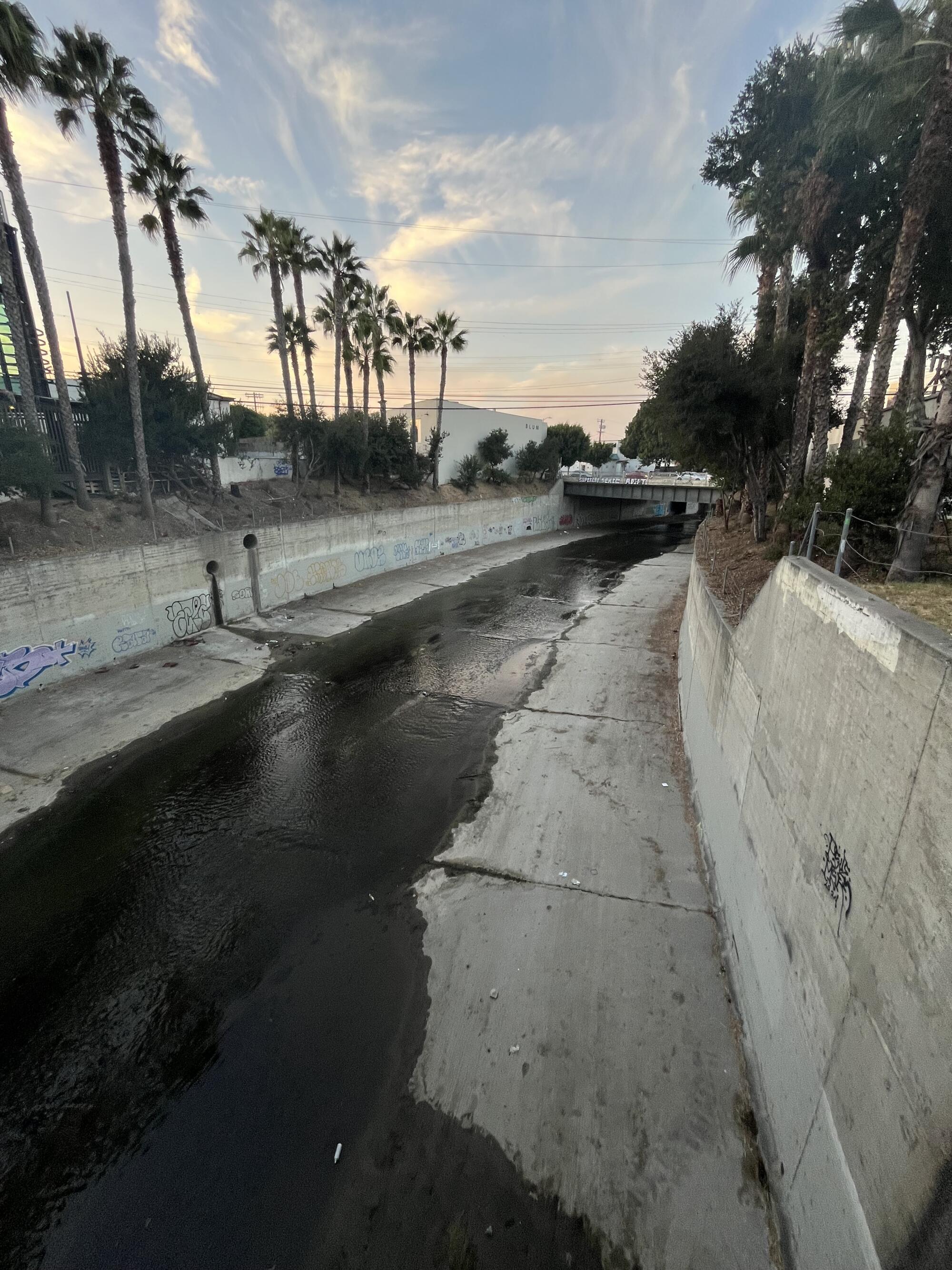
Ballona Creek neat Washington Boulevard in Culver City.
(Jaclyn Cosgrove / Los Angeles Times)
They display tidbits about movies filmed in studios here, like the 1952 musical “Singin’ in the Rain.” It was filmed at Metro-Goldwyn-Mayer Studios on this very boulevard.
We pass over Ballona Creek and soon are on a portion of Washington Boulevard with a median where trees and other plants grow. The buildings are one story. It is quiet. Compared to Commerce, it’s an oasis. You have to pay if you want serenity in L.A.
Near the Erewhon, we puzzle over the part of Washington Boulevard that briefly shares the road with Culver Boulevard. I can neither confirm nor deny that we got confused for a second.
7:51 p.m.
Outside of the Culver City DMV, we see extremely cool space-themed mural. Why this was painted at one of the most avoided places in any Angeleno’s life, I do not know. “This is astro-nuts,” I shout. I have four miles to go, I have been walking more than 12 hours. My whole job? It’s to walk. I have already started taking Tylenol for my foot and knee pain. I’m delirious, full of joy, high on the sights of Los Angeles.
We pass a metal giraffe, T. Rex and rearing horse outside La Placita Imports. The Boy & the Bear coffee shop is next door. It is one of several small local coffee shops I’d considered visiting while planning the walk, when I thought I’d be on the Westside much earlier.
We hobble into In N’ Out because we know the bathrooms will be clean. Then, near Oxford Avenue in Venice, I look up and see the greatest thing I have spotted on my walk so far: my wife. “I’m not done yet!” I croak. In my fugue state, I think she’s there to pick me up. But she’s here with our dog Maggie May, to finish with us.
8:58 p.m.
A mile to go, I start looking toward the horizon, looking for a dark vast nothingness that will mark the end of this trek. I am going to make it to the ocean.
9:39 p.m.
After 27.4 miles, passing over four rivers and under six freeways, spotting 23 dogs (including a bulldog in a bike basket) and hearing 18 honks, I am standing in the ocean. It feels like I’ve lived through three days over the past 14½ hours.
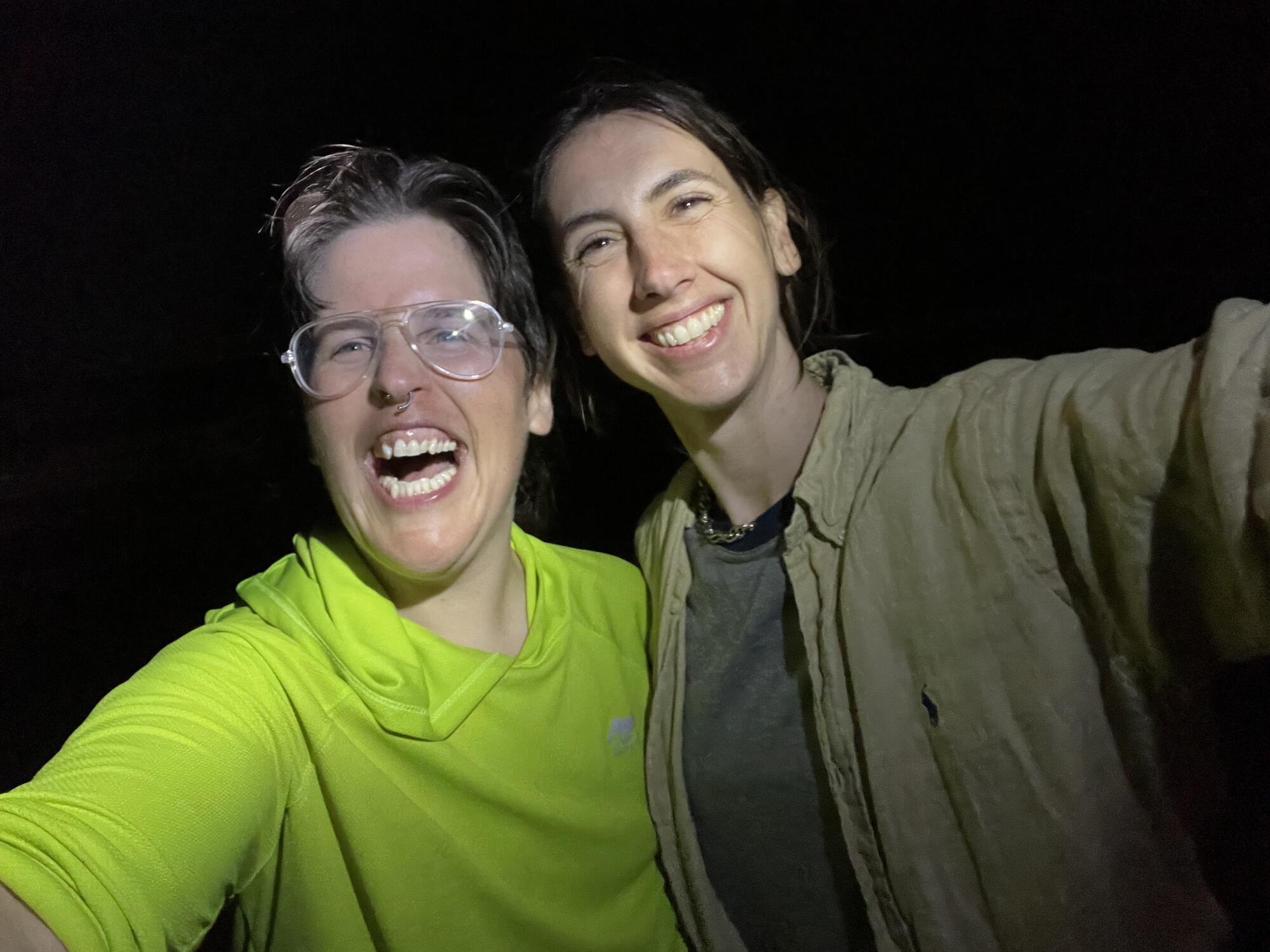
Jaclyn and Lindsay celebrate at Venice Beach after completing their walk of Washington Boulevard in one day.
(Jaclyn Cosgrove / Los Angeles Times)
What did this mega walk teach me? Washington Boulevard might not have the glitz and glamour of Hollywood, Sunset or other thoroughfares, but it is occupied by every type of L.A. resident in every type of income bracket. I saw RV encampments and historical homes, panhandlers and influencers, bicycles and Cybertrucks. Walking east to west in America’s most populous county, I was reminded — we’re all here.
Walking gives us a magical sense of presence. Our cars disconnect us and keep us focused on only our needs. We honk at strangers who might be having a worse day than us, and we miss so much. On foot, I found at least a dozen restaurants — like Natraliart Jamaican Restaurant & Market in Arlington Heights, and Samosa House and Monroe Place, both in Culver City — that I plan to visit or suggest to a friend. I spotted local theaters that are now on my list of date night ideas. And I smelled a raspberry cream dessert somewhere in Commerce that I’m still thinking about.
I also experienced industrial stretches of L.A. County with hardly any color or plant life, and wondered how that affected the people who work in that region. I saw signs banning RVs from parking in multiple cities and encampments of them elsewhere. And I breathed diesel-tinged air.
Embarking down this overlooked boulevard, I feel more motivated to explore L.A. than ever, not just for a great meal, but also to connect with my fellow Angelenos, better understand them and maybe even lend a hand. That’s the power of slowing down and talking a walk.

