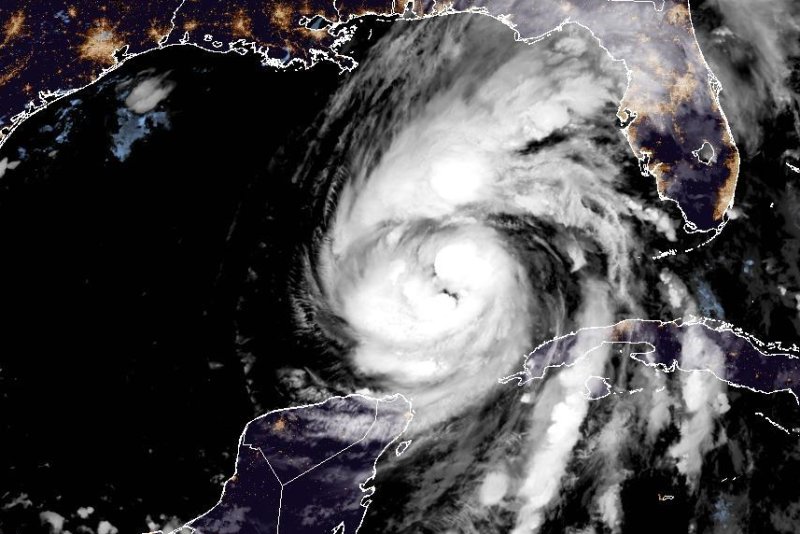
1 of 3 | Hurricane Helene is forecast to make landfall Thursday night along Florida’s Big Bend coast as a large system. Image courtesy of NOAA
Sept. 26 (UPI) — Hurricane Helene continued its trek toward the Gulf coast of Florida early Thursday, as forecasters warned that the storm would strengthen to a Category 4 behemoth before making landfall Thursday night in the Big Bend region.
Such a powerful storm will likely bring widespread destruction, and forecasters were warning early Thursday that “preparations to protect life and property should be rushed to completion.”
Florida Gov. Ron DeSantis has issued a state of emergency for 61 of Florida’s 67 counties ahead of the storm’s landfall.
“Florida is preparing for widespread impacts from Hurricane Helene,” he said.
In its 1 a.m. CDT update, the National Hurricane Center located Helene in the Gulf of Mexico about 385 miles southwest of Tampa, Fla., and 425 miles south-southwest of Apalachicola, Fla.
It maintained its 85 mph sustained winds it had overnight, but strengthening is forecast over Thursday ahead of landfall, when it could reach Category 4 strength, with winds between 130 and 156 mph. Helene was moving north at 12 mph.
The storm is expected to be “a large major hurricane when it reaches the Big Bend coast of Florida,” the NHC said.
“Helene will move across the eastern Gulf of Mexico tonight and Thursday and cross the Florida Big Bend coast Thursday evening,” the NHC forecasters said. “After landfall, Helene is expected to turn northwestward and slow down over the Tennessee Valley on Friday and Saturday.”
Forecasters are warning of potentially catastrophic hurricane-force winds, a life-threatening storm surge and deadly flash and urban flooding.
Normally dry areas near the coast are expected to flood due to the combination of tides and the deadly storm surge, which from Carrabelle to the Suwannee River could reach as high as 20 feet.
The storm will bring heavy rainfall amounts to the Tennessee Valley on Friday and Saturday with strong, damaging winds — especially in gusts — that will penetrate well inland over the southeastern United States, including over higher terrain in the southern Appalachian mountains.
Hurricane-force winds currently extend outward as far as 35 miles from the center of the storm, while tropical storm-force winds can be felt as far as 345 miles away, forecasters said.
Helene should weaken after landfall on the Gulf Coast, forecasters said, adding that the storm’s fast forward speed is what will prove to be the most damaging to property and life.
A tropical storm warning was extended northward along the coasts of Georgia and South Carolina to north of South Santee River, and westward along the Florida Gulf coast to the Okaloosa/Walton county line.
Meanwhile, a storm surge warning is in effect east of Mexico Beach southward to Tampa Bay and Charlotte Harbor.
