A week before Los Angeles shut down in spring 2020, my two friends, wife, dog and I hiked the Bridge to Nowhere.
Setting off into Angeles National Forest on that March morning, we had no idea how special that hike would feel later when local trails closed out of an abundance of caution over COVID-19. Even the car ride home felt precious in retrospect, all of us crammed together in my friend’s Prius, exhausted and laughing after we realized we’d missed a few turns and accidentally hiked 2½ extra miles.
Newsletter
You are reading The Wild newsletter
Sign up to get expert tips on the best of Southern California’s beaches, trails, parks, deserts, forests and mountains in your inbox every Thursday
You may occasionally receive promotional content from the Los Angeles Times.
I’ve found myself thinking back to that memory this past week as I watched from my kitchen window as massive pyrocumulous clouds formed above Glendora. The Bridge fire started Sept. 8 and exploded over a few days from less than 1,000 acres to almost 55,000 acres, threatening lives and destroying homes in the beautiful mountain communities of Mount Baldy and Wrightwood.
A preliminary map of the fire’s footprint shows that both the Bridge to Nowhere trailhead and the bridge itself were in the fire’s path. I’ve collected a round-up of some of the major local trails that appear to have been affected by the wildfires. It remains unclear how badly burned these areas are, but I join many who’ve been grieving over the destruction from not only the Bridge fire but also the Line fire in San Bernardino County and the Airport fire in Orange and Riverside counties.
Our personal history with a trail is part of why we cherish wild places. Being able to revisit a path over and over again helps us rediscover its beauty, watch it change with the seasons or catch a rare glimpse of some natural phenomenon, like a kaleidoscope of migrating butterflies. Even the oldest places can feel new. That promise of awe and surprise is what drives us back to our favorite spots in our local mountains.
We do not know what conditions will greet us when these burned areas are finally reopened. In the interim, for our own safety and to allow for whatever recovery is needed in the aftermath, we should head out to trails spared from any wildfires this season. I have found that practicing gratitude on the trail helps me remain present and joyful of what we still have.
Below you’ll find three hikes through forests that will provide you a necessary escape through similar landscape to what’s been burned. I hope you find peace and a reprieve from heartache on these paths. I know I have.
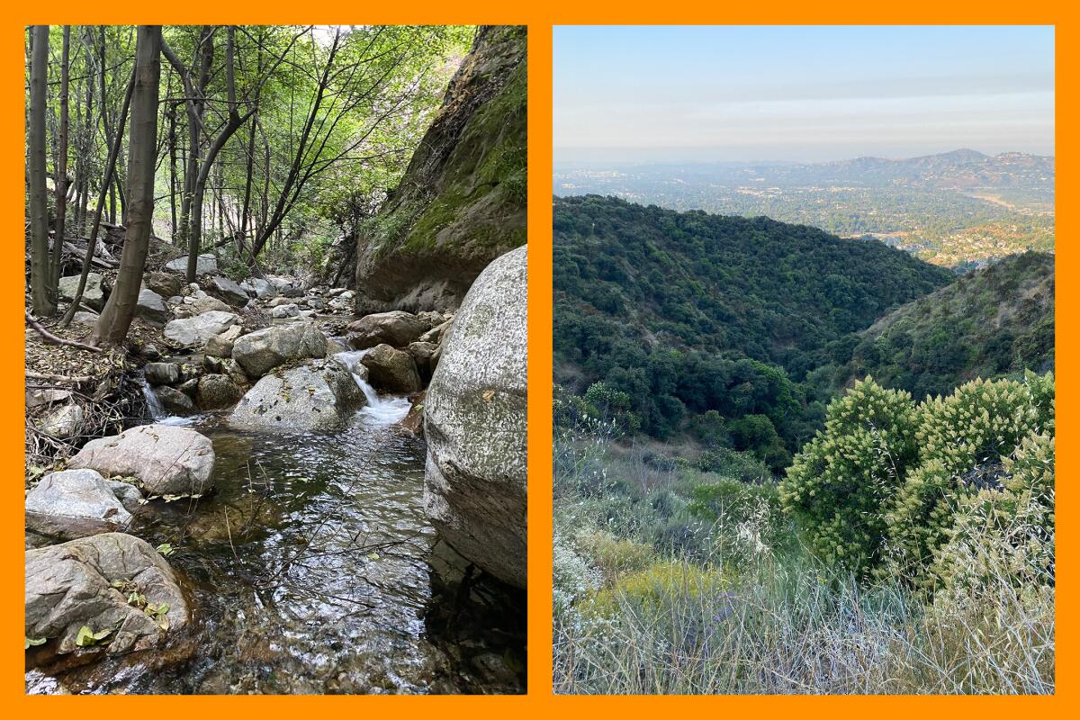
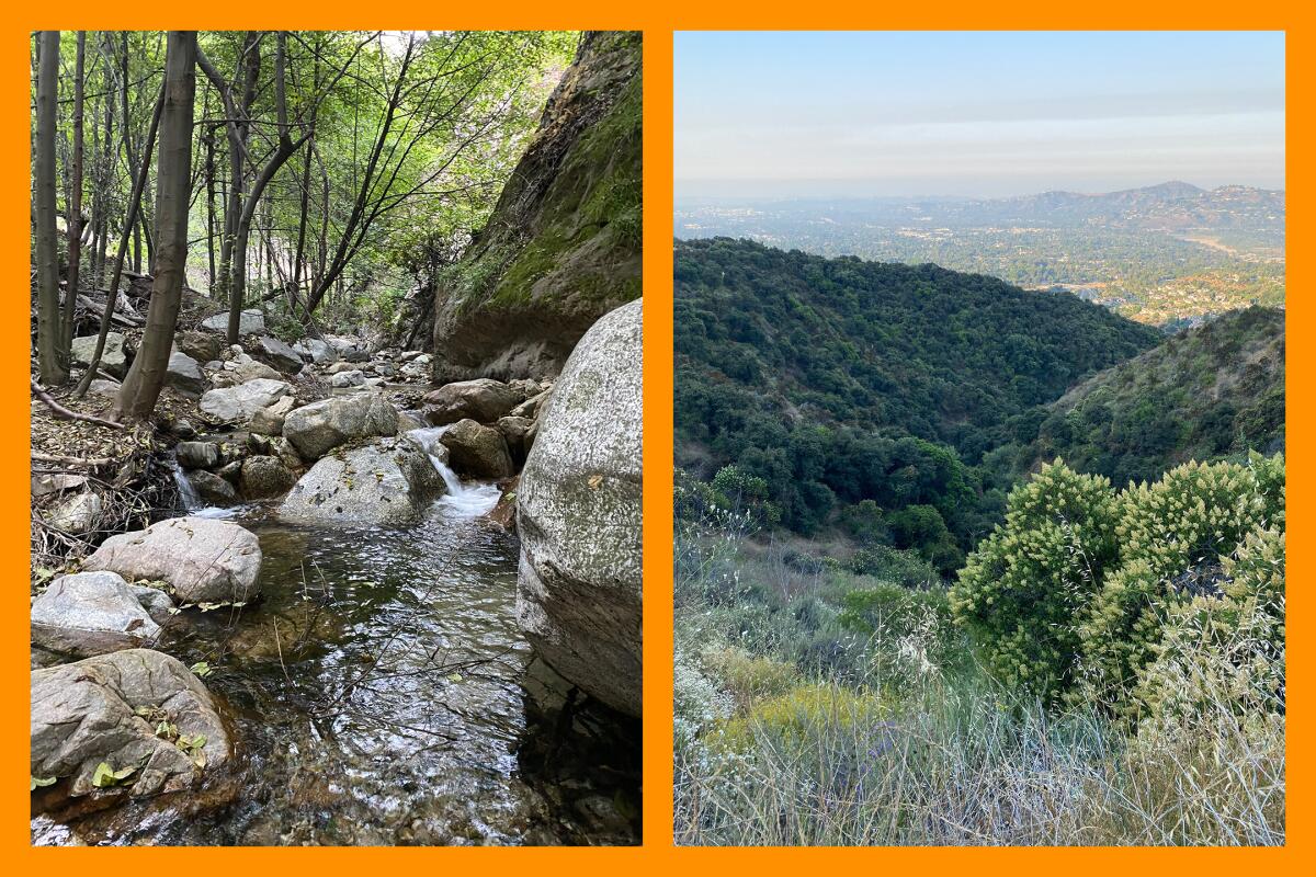
Millard Creek, left, runs alongside this hike to the Dawn Mine. The view as you start down the Dawn Mine and Sunset Trail hike, right.
(Jaclyn Cosgrove / Los Angeles Times)
Dawn Mine and Sunset Trail loop
Distance: 5.5 miles
Elevation gain: About 1,500 feet
Difficulty: Moderate
The Dawn Mine and Sunset Trail loop near Altadena is one of my favorite close-to-home hikes. It features nice views of nearby cities, a cool creek (still flowing in September), seasonal wildflowers and interesting granite rock walls.
To begin, you’ll walk about a third of a mile on a paved road before following signage on the left to turn onto the trail. You’ll descend into the canyon, passing above Millard Falls. Please do not take the unofficial trail down to the falls — it’s very sketchy. Instead, continue on the trail down to Millard Creek, enjoying the shady path and the sound of the flowing water. You’ll head east and northeast until reaching Dawn Mine, which former Times outdoors writer John McKinney noted was a literal gold mine from 1895 through the 1950s. These days, it’s a figurative gold mine for local history buffs or those who want to take a cool selfie.
It is not safe to enter the mine, but you can enjoy the frigid breeze coming out of its mouth. Mountain air conditioning.
It’s about two miles to reach the mine. You can turn around once you get there and head back the way you came or continue on the loop. Be advised that the rest of the loop is exposed but does offer great views as you climb.
Take note: This is a popular hiking area, so you’ll want to plan accordingly, as parking is limited. Also, there are several trails nearby, so make sure to either download the map on your outdoors app or bring a paper map (easy to print from CalTopo).
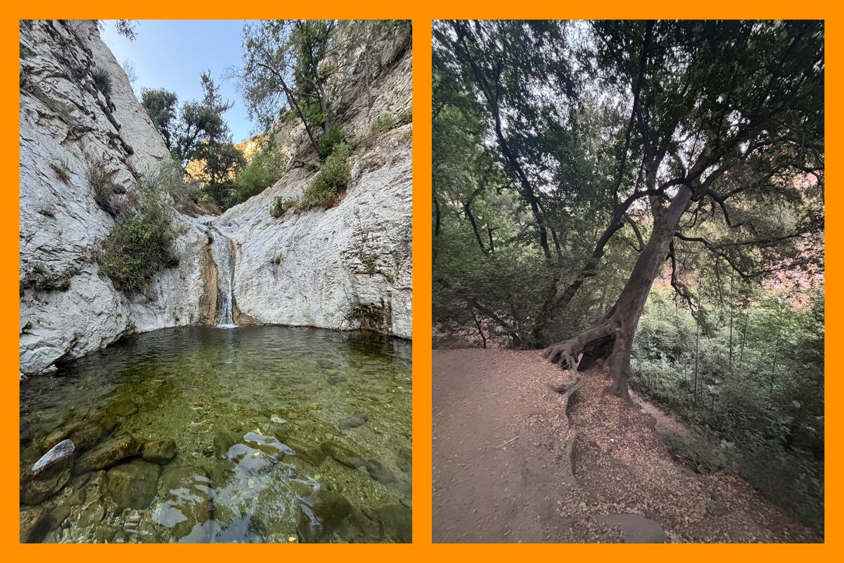
The water is cold at Switzer Falls, left, but worth dipping your sore feet into; One of many oak trees growing at an interesting angle on the Switzer Falls hike, right.
(Jaclyn Cosgrove / Los Angeles Times)
Switzer Falls via the Gabrielino Trail
Distance: 3.6 miles
Elevation gain: About 700 feet
Difficulty: Moderate
The hike to Switzer Falls along the Gabrielino Trail is an absolute treat in Angeles National Forest. It includes a river with several deep pools to swim in, loads of shade and interesting vistas of nearby mountains, including Strawberry Peak.
The first section is a wide path shaded by massive coast live oaks, some jutting from the hillsides at angles that seem to defy gravity. You’ll cross the Arroyo Seco multiple times, so it’s best to wear shoes you don’t mind getting wet and consider bringing trekking poles to help you balance through the crossings. Be mindful where you step, as rocks in the river can be surprisingly slick.
The trail will lead you to an exposed, at times jagged, cliffside. This section might be challenging for those fearful of heights, given the significant drop, but the small trees growing alongside the trail do offer you something to focus on.
Two important safety notes: You will see a sign that reads, “Not a trail.” Please heed its advice. People frequently take an unofficial path and climb to the top of the falls. This is very dangerous, as the rocks are slippery, and people regularly fall, prompting rescue. I once interviewed a man who fell off from here and was grateful that he survived. Second, once you reach Switzer Falls, you might look up and notice a rope at the top of the short waterfall. People also hike up to this section. Again, people regularly fall. It’s a bad idea and simply not worth the risk. There is no guarantee that rescue will be swift.
If you’d like to extend your journey, you can first head to the falls and then follow signs for Bear Canyon Camp to hike a bit more through the canyon and along the river. You’ll be greeted by moss-covered rock walls and the spicy smell of native bay laurels. This side trek makes the journey about 7.5 miles round trip.
Switzer Falls is about 22 miles east of the Bridge fire footprint. But when I visited, I wouldn’t have guessed there were any fires in the area. The air was crisp and clean.
Like Dawn Mine and Sunset Loop Trail, this also happens to be a very popular trail, so plan accordingly, as parking can fill up on weekends. If you can, hit it on a weekday afternoon when it’s far less populated. I hiked it on a Thursday and saw about 10 people.
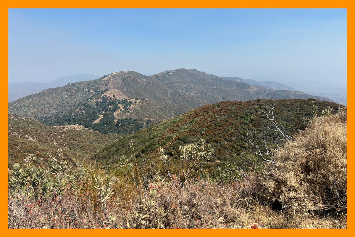
A view from the Los Pinetos Trail of the area around Placerita Canyon.
(Jaclyn Cosgrove / Los Angeles Times)
Los Pinetos Trail
Distance: About 7 miles
Elevation gain: About 1,900 feet
Difficulty: Challenging
The Los Pinetos Trail through Placerita Canyon State Park is about a 7-mile round trip through an east-west canyon before reaching a large shaded oak woodlands. It is a challenging but rewarding trek that features great views of nearby peaks, including Magic Mountain, and is home to several migratory birds. If you’re lucky, you may even spot a horned lizard, a rare treat.
At first glance, you might wonder why I’m calling this a “forest hike,” given its desert-like beginnings. This region is what’s known as a transition zone between the San Gabriel Mountains and the Mojave Desert. The first portion of the trail is exposed but does offer intermittent shade until you reach the oak woodlands.
I was cooled by a nice breeze at multiple sections that offered a reprieve from both the heat and the bugs that swarmed my face.
There’s a seasonal stream during the spring, but there are no water crossings at present. There’s a .6-mile waterfall trail that’s an easy side trip.
Be mindful of snakes in the area. When I arrived, I stopped to take a photo of the trail sign and heard rustling in the bushes nearby. I assumed it was birds or squirrels. But, as I started the trail, I was petrified when two snakes — I have no idea what kind — rose out from the bushes and looked at me. Just as I pondered whether I should have written a will before this hike, they wrapped themselves around each other and, in the throes of passion, fell back into the bushes. Perhaps I interrupted the reptilian version of a smoke break.
As I hiked up, I also spotted a small yellow bird, likely either a lesser goldfinch or a yellow warbler, and heard what sounded like a pair of wrentits. This trail is a great hike for birders, especially during peak bird migration in late April through May.
The portion that is oak woodlands feels like you’re entering a different world. Placerita Canyon is home to four species of oak trees, and dozens provide an incredible canopy over an otherwise hotter region of L.A. County.
At about 2.5 miles, you’ll reach the Wilson Canyon Saddle, where there is a vault toilet and a picnic table. You could stop here, as you’ve made it through the oak woodlands. The rest of the trail is a dirt fire road. On a clear day, it does offer great views of the surrounding region, but it ends anticlimactically at fenced-in telecommunications towers and a building.
For a fun side trip, stop by the impressive Placerita Canyon Nature Center, less than two miles west of the trailhead, to view more than 25 native animals, including owls and hawks, and see the Oak of the Golden Dream, where the first authenticated discovery of gold in California was made. Hours available at placerita.org.

3 things to do
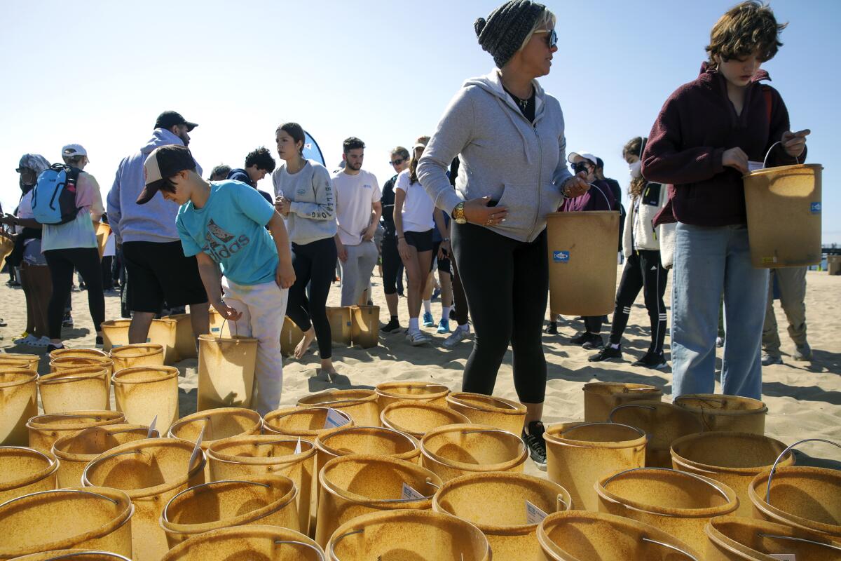
Volunteers collect buckets to take part in Nothin’ but Sand Cleanup, organized by Heal the Bay in Santa Monica.
(Irfan Khan / Los Angeles Times)
Clean up the beach in a coastal city near L.A.
Join thousands of volunteers from 9 a.m. to noon Saturday at several beaches along the L.A. County coastline for Heal the Bay’s 35th year of Coastal Cleanup Day. Last year, about 7,000 volunteers removed more than 16,400 pounds of trash and recycling from 97 miles of beach, river, underwater and trail cleanup sites. This year, there will be more than 50 cleanup events, stretching from Leo Carillo State Beach in Malibu to Alamitos Park in Long Beach. At Bruce’s Beach in Manhattan Beach, Outdoor Afro and EnvironmentallyU will guide the cleanup and educate volunteers about the environmental justice history of the site. The groups will also lead a meditative yoga practice. Find an event near you at healthebay.org.
Celebrate Black Walnut Day at Ascot Hills Park in L.A.
Celebrate the Southern California black walnut, Juglans californica, as a symbol of resilience at this year’s Takaape’ Waashut NELA Black Walnut Day from noon to 5:30 p.m. Sunday at Ascot Hills Park. Activities include a black walnut dice game, a natural dye workshop, tenant rights workshops, native seed processing, hikes and musical performances. All activities are free and open to children and adults. There will also be a free lunch service. A schedule of events is here. Event organizers ask attendees to test for COVID-19 beforehand and mask at the event. You can simply attend or sign up to volunteer. Learn more at Coyotl + Macehualli’s Instagram page.
Hike near creeks in Santa Barbara
Learn about creeks, watersheds and the ocean from Saturday through Sept. 28 during Creek Week, hosted by local governments and organizations in Santa Barbara, Goleta and Carpinteria. Events include a free docent tour at the Carpinteria Salt Marsh Nature Park and a bike tour along Mission Creek to the beach. There’s also a wildlife kayak tour Sunday with the city of Carpinteria, which is limited to 12 people. RSVP required to [email protected]. You can also take an easy, kid-friendly stroll on Sept. 26 along the San Antonio Creek trail in Tucker’s Grove County Park. Find a full schedule of events at sbcreekweek.com.

The must-read
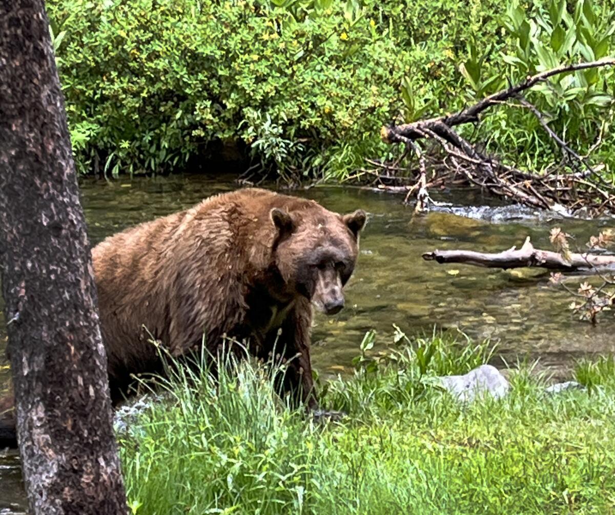
A 500-pound bear, nicknamed Victor, visits a Mammoth Lakes campground.
(Kathy Spaulding)
Last week, we learned about how to react if we see a bear on the trail. As I was writing that edition of The Wild, I couldn’t help but think about the fate of Victor, a 500-pound bear who was beloved in Mammoth Lakes but was ultimately euthanized. Times reporter Lila Seidman spoke with those who knew Victor well about his tragic ending. Although we humans have the responsibility to ensure that our food is secure from wildlife while outdoors, what’s the responsibility of government to keep these animals safe? That’s a question raised in Lila’s story that’s worth considering.
Happy adventuring,

P.S.
If you find yourself in the San Diego area this week, you can shop from Thursday to Sunday at the Columbia Employee Store at prAna in Carlsbad. Discounts will be up to 50% off retail pricing. Find details here.
For more insider tips on Southern California’s beaches, trails and parks, check out past editions of The Wild. And to view this newsletter in your browser, click here.
