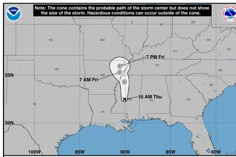
Sept. 12 (UPI) — A weakened but still potent Francine was dumping heavy rain as it moved inland Thursday, transitioning from a hurricane to a tropical depression. Winds dropped to 35 mph, but millions of people remained concerned about flooding.
Up to 14 million people were under flood watches over an area stretching from the Florida Panhandle and New Orleans to as far north as Memphis.
“Francine will continue to lose wind energy as it spends the remainder of its life over land,” AccuWeather lead hurricane expert Alex DaSilva said. “However, as it transitions to a tropical rainstorm, it will still be very capable of producing life-threatening conditions.”
Thunderstorms that spawn tornadoes threaten residents from the central Gulf Coast to Tennessee in the north, Georgia in the east and north-central Florida.
The National Hurricane Center said in a statement that “Francine will continue to bring heavy rainfall and the risk of flash and urban flooding, along with river flooding, across portions of the Lower Mississippi Valley, Tennessee Valley and the Southeast.”
According to Accuweather, Francine will carry 1 to 4 inches of rain northward into the middle Mississippi and lower Ohio valleys “with a pocket where 4 to 8 inches of rain will fall with locally higher amounts centered on the state of Mississippi.”
As of 3 p.m. Thursday, poweroutage.us reported 294,747 Louisiana customers without electrical power. Mississippi had 19,758 outages. Alabama had 40,649 and Tennessee had 11,667 without power.
According to the National Weather Service, wind advisories were in effect Thursday for parts of Alabama, Georgia, Tennessee, Arkansas, Florida, Louisiana and Mississippi. Francine was still bringing strong winds with gusts as high as 50 mph.
According to WWNO in New Orleans, the highest rainfall totals were 8 to 10 inches, mostly in Lafourche, St. John, St. Charles and Jefferson parishes.
St. Charles Parish President Matthew Jewell reported Wednesday the parish was experiencing high water, flooding streets and homes.
