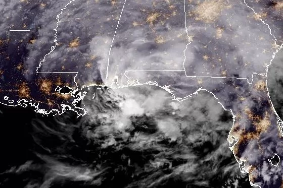
Francine, which made landfall in southern Louisiana on Wednesday evening and has since been downgraded to a tropical storm, was located just northwest of New Orleans early Thursday. Image courtesy of NOAA
Sept. 11 (UPI) — Francine was downgraded to a tropical storm late Wednesday after making landfall in Louisiana’s southern parish of Terrebonne as a Category 2 storm earlier in the day.
It had formed in the Gulf and came ashore Wednesday evening, battering southern Louisiana’s Terreboone with winds of 100 mph, but the system began to quickly degrade as forecast.
In its 2 a.m. EDT update, the National Hurricane Center said Francine was packing maximum sustained winds of 50 mph, making it a tropical storm.
It was located about 20 miles northwest of New Orleans and moving northeast at 14 mph.
Forecasters had said that the storm was expected to diminish quickly over land, but risks for property and people remain into Thursday.
“Francine is expected to bring heavy rainfall and the risk of considerable flash and urban flooding, along with river flooding, across southeastern Louisiana, Mississippi, far southern Alabama and the Florida Panhandle through Thursday night,” the NHC said.
“Flash and urban flooding is probable across the Lower Tennessee Valley and Lower Mississippi Valley tonight into Friday morning.”
It said heavy rain was spreading across southern Mississippi and Alabama early Thursday.
“As Francine continues inland, the storm will spin down and likely become a tropical depression by late Thursday and a post-tropical cycloneThursday night or early Friday,” it said.
A storm surge warning was in effect for Morgan City, La., to the Mississippi-Alabama border, Vermilion Bay, Lake Maurepas and Lake Pontchartrain.
A tropical storm warning was in effect for Morgan City, La., to the Mississippi-Alabama border, Lake Maurepas and Lake Pontchartrain, including metropolitan New Orleans.
“The combination of a dangerous storm surge and the tide will cause normally dry areas near the coast to be flooded by rising waters moving inland from the shoreline,” the NHC update statement said.
“Francine is expected to bring storm total rainfall of 4 to 8 inches, with local amounts to 12 inches across southeastern Louisiana, Mississippi, far southern Alabama and the Florida Panhandle through Thursday night.”
Port Fourchon to the mouth of the Mississippi River could see a storm surge as high as 7 feet while High Island, Texas, near the Bolivar Peninsula, could reach 5 feet.
“The deepest water will occur along the immediate coast near and to the east of the landfall location, where the surge will be accompanied by large and dangerous waves,” the center said. “Surge-related flooding depends on the relative timing of the surge and the tidal cycles and can vary greatly over short distances.”
The NHC said storm surge is not expected to pose a threat to reduction system levees.
So far this hurricane season there have been five other named storms — Alberto, Beryl, Chris, Debby and Ernesto. Beryl, Debby and Ernesto became hurricanes.

