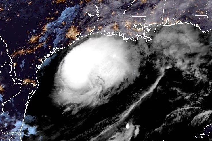
Francine grew into a hurricane Tuesday evening ahead of its anticipated landfall in Louisiana on Wednesday. Image courtesy NOAA
Sept. 9 (UPI) — Hurricane Francine was continuing to strengthen early Wednesday as it moved across warm Gulf waters toward Louisiana where it is forecast to make landfall later in the day.
In its 2 a.m. EDT Wednesday update, the National Hurricane Center said Francine had maximum sustained winds of 90 mph, up from 75 mph a few hours earlier. It had reached Category 1 status on the Saffir-Simpson scale Tuesday evening.
Forecasts said the storm is expected to continue intensifying prior to making landfall late Wednesday afternoon or evening in Louisiana but will experience rapid weakening afterward.
The system was located early Wednesday by the NHC forecasters about 195 miles east-northeast of the mouth of the Rio Grande and roughly 275 miles southwest of Morgan City, La.
Francine had been relatively stationary overnight, but forecasters said it was starting to pick up speed as it moved toward the Louisiana coast at about 10 mph.
NHC forecasters said that the storm could grow to nearly Category 2 hurricane strength over Wednesday morning.
“Now that Francine has a well organized core, significant strengthening seems likely through Wednesday morning while the system remains over very warm waters and in low wind shear conditions,” it said.
Once landfall is made, the storm is expected to move northward into Mississippi on Wednesday night and Thursday, it said.
A Hurricane Watch is in effect for Lake Maurepas, Lake Pontchartrain and metropolitan New Orleans in Louisiana.
A Tropical Storm Warning also is in effect for the Louisiana coast east of Sabine pass to the Vermilion-Cameron Line and the Alabama coast from the Mississippi-Alabama border to the Alabama-Florida border.
The Hurricane Warning for the southwestern coast of Louisiana from Sabine Pass to Cameron has been changed to a Tropical Storm Warning.
The Storm Surge Warning is in effect for Cameron, La., to the Mississippi-Alabama border, Vermilion Bay, Lake Maurepas and Lake Pontchartrain.
Meanwhile, Francine is packing heavy rain, which is expected to turn into urban and coastal flooding once the storm reaches land.
The storm system is expected to bring storm total rainfall of 4 to 8 inches, with local amounts to 12 inches across much of Louisiana and Mississippi through early Friday, according to forecasters, who warned the increased risk will bring “considerable flash and urban flooding.”
Tropical storm-force winds are extending some 35 miles from the center of the storm.
Port Fourchon to the mouth of the Mississippi River could see a storm surge as high as 7 feet while High Island, Texas, near the Bolivar Peninsula, could reach 5 feet.
“The deepest water will occur along the immediate coast near and to the east of the landfall location, where the surge will be accompanied by large and dangerous waves,” the center said. “Surge-related flooding depends on the relative timing of the surge and the tidal cycles and can vary greatly over short distances.”
The NHC said storm surge is not expected to pose a threat to reduction system levees.
So far this hurricane season there have been five other named storms — Alberto, Beryl, Chris, Debby and Ernesto. Beryl, Debby and Ernesto became hurricanes.
