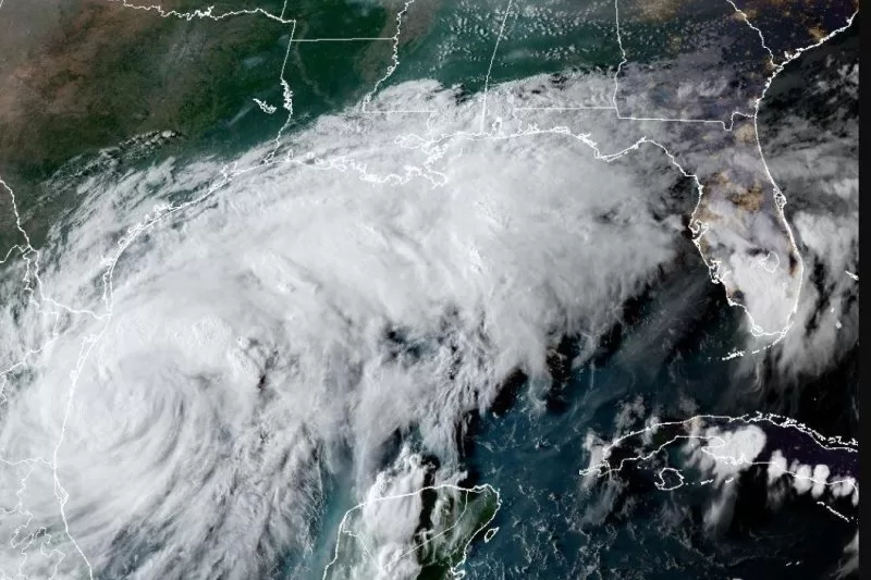
Tropical Storm Francine emerged in the Gulf of Mexico on Monday and was forecast to bring heavy rain to parts of Louisiana and Texas. Image courtesy NOAA
Sept. 9 (UPI) — Tropical Storm Francine is intensifying and is projected to reach Louisiana and Texas by Wednesday as the Atlantic’s fourth hurricane this season, according to the National Hurricane Center.
On Monday morning, the tropical disturbance in the Gulf of Mexico turned into a tropical storm, the sixth named one this season in the Atlantic.
In its 5 p.m. EDT update, NHC said Francine had maximum sustained winds of 65 mph as it was located about 150 miles south-southeast of the mouth of the Rio Grande and about 435 miles south-southwest of Cameron, La. Francine was moving 7 mph in a northerly direction.
In the 11 a.m. update, the storm become a tropical storm with maximum sustained winds of 50 mph. In the 2 p.m. update, it was 60 mph.
“Francine quickly becoming better organized,” the NHC said. “Storm surge and hurricane warnings issues for parts of the Louisiana coast.”
A hurricane warning has been issued for the Louisiana Coast from Sabine Pass to Morgan City.
A tropical storm warning is in effect for the Louisiana Coast east of Morgan City to Grand Isle and from High Island Texas to Sabine Pass.
A tropical storm watch has been issued for the Texas Coast from Port Mansfield northward to High Island.
Francine is packing heavy rain, which is expected to turn into urban and coastal flooding once the storm reaches land.
On the forecast track, Francine is anticipated to be just offshore of the coasts of northeastern Mexico and southern Texas through Tuesday, and nearing the Louisiana and Upper Texas coastline on Wednesday.
Tropical storm force winds are extending some 160 miles from the center of the storm.
Forecasters predict rainfall from Francine could range from 4-8 inches with isolated areas receiving as much as 12 inches. Storm surge could reach as high as 10 feet in Cameron and Vermillion Bay in Louisiana.
Port Fourchon to the mouth of the Mississippi River could see storm surge as high as 7 feet while High Island, Texas, near the Bolivar Peninsula, could see it reach 5 feet.
“The deepest water will occur along the immediate coast near and to the east of the landfall location, where the surge will be accompanied by large and dangerous waves,” the center said. “Surge-related flooding depends on the relative timing of the surge and the tidal cycles and can vary greatly over short distances.”
The NHC said storm surge is not expected to pose a threat to reduction system levees.
So far this hurricane season there have been five named storms — Alberto, Beryl, Chris, Debby and Ernesto. Beryl, Debby and Ernesto were hurricanes.