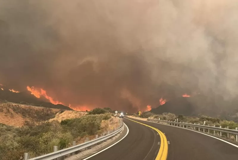
1 of 2 | The Line Fire was raging at SR-330 above the fire station in San Bernardino County. The highway was closed in both directions. Photo by Cal Fire/Facebook
Sept. 7 (UPI) — Residents of hundreds of homes near the San Bernardino National Forest in southern California were ordered to evacuate Saturday as the Line Fire grew exponentially.
Citing “an immediate threat to life,” law enforcement issued mandatory evacuation orders in the area. San Bernardino Sheriff’s Office listed the communities of Running Springs and Arrow Bear Lake on Saturday. That was one day after parts of Highland, Calif., were also placed under evacuation as the quickly advancing wildfire drew closer to the city of San Bernardino.
The fire started Thursday night.
Highways 330 and other roads in the area were also closed as officials fought to contain the Line Fine, which exploded to more than 17,459 acres and 0% contained Saturday night.
CalFire, the state forestry and fire protection agency, said 35,405 structures are threatened, including single and multi-family homes, as well as commercial buildings and other minor structures. So far no damages have been reported.
Three injuries were reported among fire personnel and civilians.
There are currently 628 personnel, 65 engines, two helicopters, three dozers and one water tender are assigned to the fire.
“Smoke remains a challenge for aircraft, limiting access to parts of the fire,” CalFire said in a situation summary. “Limited resources and logistical support have hampered fire control efforts.”
CalFire said “hot and dry conditions mixed with thunderstorms are expected to challenge firefighters for the next few days.”
Southern California is sweltering under an excessive heat warning and record-high temperatures for Sept. 7 were recorded across the region. Dangerously hot conditions with high temperatures of 102 to 110 degrees Fahrenheit were seen across San Bernardino and Riverside counties.
The blaze was moving in a north-northeasterly direction.
The main concern was on the fire’s eastern flank, where containment was thought to be most threatened, while its leading western edge was about 12 miles east of the San Bernardino International Airport.
“Resources continue to respond from throughout the state,” the California Department of Forestry and Fire Protection reported. “Fire crews continue to make progress during the nighttime hours due to higher humidity and nighttime water-dropping helicopters.”
Crews are being hampered by the steep terrain and lack of access to some areas of the fires but are being supported by fixed-wing and rotary aircraft.