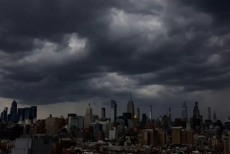
Possibly severe storms with damaging winds are forecast for Labor Day weekend across the Northeast, Ohio Valley, mid-Atlantic and Appalachians as millions of holiday travelers crowd the nation’s airports. File Photo by John Angelillo/UPI |
License PhotoAug. 30 (UPI) — Heavy rain with the possibility of damaging winds is on tap for the Northeast and Gulf states over the Labor Day holiday weekend as a record number of travelers are expected to surge through the nation’s airports.
Meanwhile, the interior Northwest and northern Rockies will be baking in very hot temperatures approaching 100 degrees Fahrenheit, forecasters warned.
The potentially rough weather is on tap as U.S. airports are bracing for their busiest Labor Day travel period in history. The Transportation Security Administration is predicting 17 million travelers will pass through its checkpoints, peaking Friday when 2.86 million people are expected to be screened.
Travelers will encounter storms mainly on Saturday and Sunday in the Northeast, Ohio Valley, mid-Atlantic and Appalachians as a massive cold front moves from west to east across the country, according to the National Weather Service’s Storm Prediction Center.
Severe thunderstorms capable of producing damaging gusts are possible across portions of the central Appalachians into the Northeast on Saturday, while a few strong to severe gusts may also occur over parts of the Ohio and Tennessee valleys and across northern Minnesota and Wisconsin into Upper Michigan.
The leading edge of the cold front is forecast to stall across the South and Southeast later during the weekend, producing widespread showers and storms across the region all the way through Labor Day.
The forecast is more dire for the Gulf Coast, however, where a tropical disturbance will linger just offshore of Texas and Louisiana, producing a concentrated area of heavy rain and thunderstorms. High rain rates and repeating rounds of storms may lead to scattered instances of flash flooding, especially in urban and flood prone areas, the Weather Service warned.
In parts of the Northwest, meanwhile, the Labor Day weather story will be one of scorching heat. High temperatures are forecast to be 10-20 degrees above normal, reaching the mid-to-upper 90s to near 100 degrees in areas such as eastern Washington and Oregon and northern Idaho.
The Weather Service issued heat advisories in effect from late Saturday morning stretching into Monday night for portions of central, north central, and northeast Oregon and central, south central, and southeast Washington.
Elsewhere in the West, temperatures will generally be near or just above average.