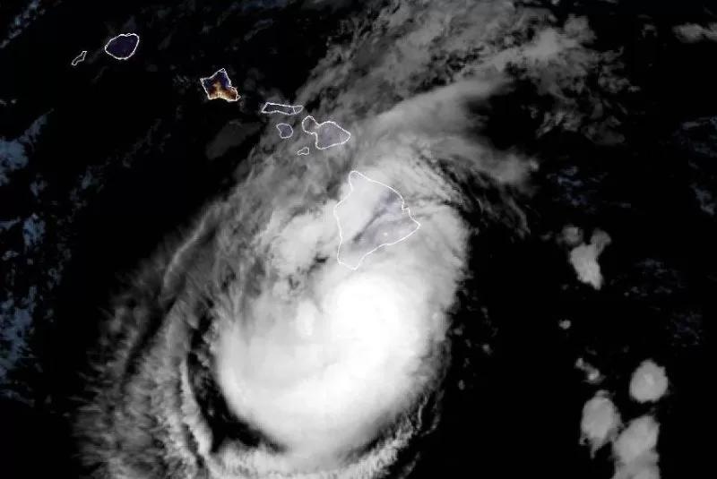
Hurricane Hone was moving toward Hawaii and forecasters expect it to dump heavy rain, especially over Hilo. Image courtesy National Oceanic and Atmospheric Administration
Aug. 24 (UPI) — Hone intensified into a hurricane as it neared Hawaii’s Big Island on Sunday. Hone was about 115 miles south-southwest of Hilo and about 265 miles southeast of Honolulu with maximum sustained winds of 80 mph. The storm was traveling 16 mph westward, according to the 2 a.m. HST update from the Central Hurricane Center.
Hone was designated as the eighth named storm in the Pacific in the update three hours earlier. It is the third hurricane.
A tropical storm warning remains in effect for Hawaii County.
Hone is moving toward the west and this motion is expected to continue into Monday, followed by a slight decrease in forward speed, the agency said.
“Hone is expected to produce a total rainfall of 6 to12 inches over mainly windward and southeast-facing slopes of the Big Island, with locally higher amounts possible,” the hurricane center said. “Rainfall totals of 2 to 4 inches will be possible over portions of the smaller islands, mainly windward.
Also, surf is associated with large swells Sunday. Expect dangerous conditions with life-threatening surf and rip currents, the storm center said.
Gov. Josh Green proclaimed a state of emergency Saturday. The proclamation allows the governor to activate the National Guard and a state disaster fund while suspending certain aspects of state law.
Camping areas on the Big Island were closed as a precaution, the governor’s office said.
Hurricane Gilma, a Category 4 storm, was about 1,480 miles east of Hilo and about 1,500 miles west of the southern tip of Baja California with maximum sustained winds of 130 mph. It was moving west-northwest at 9 mph.
A gradual weakening is expected although Gilma should remain a hurricane through early next week, the hurricane center said.
