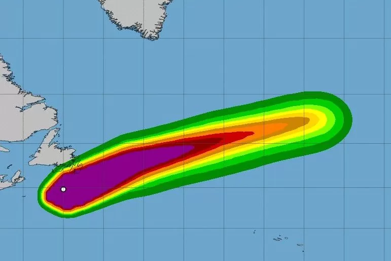
Hurricane Ernesto was passing south of Canada’s Newfoundland late Monday. Image courtesy of NOAA
Aug. 20 (UPI) — Hurricane Ernesto was passing south of Canada’s Newfoundland late Monday as it continues to create “dangerous” beach conditions along the U.S. East Coast.
The system had maximum sustained winds of 80 mph as of 11 p.m. EDT, according to the National Hurricane Center.
Ernesto was located about 70 miles south of Cape Race, Nova Scotia.
It was moving northeast at 35 miles per hour.
Forecasters said Ernesto was at its closet approach to Newfoundland and should move into the open Atlantic on Tuesday.
Hurricane-force winds extend outward up to 45 miles from the center and tropical storm-force winds up to 220 miles away.
In southeastern Newfoundland, “large breaking waves could bring the possibility of coastal flooding, particularly along southwest-facing shorelines from Burin east to Avalon regions,” NHC said.
Though Ernesto is forecast to remain well off the U.S. East Coast, the forecasters are warning those who reside there that swells generated by the hurricane will be hitting the coast during the early half of this week.
“Beachgoers should be aware that there is a significant risk of life-threatening surf and rip currents, and should stay out of the water if advised by lifeguards,” NHC said.
In New York City, ocean-facing beaches were closed for swimming in Brooklyn and Queens over the weekend. That includes Coney Island.
Accuweather.com forecasts Ernesto to impact the British Isles from Wednesday night to Thursday.
“As Ernesto moves along, it will be of concern for ships at sea over the North Atlantic from Tuesday to Wednesday,” Accuweather.com forecaster Alex Sosnowski said. “The storm will accelerate and may reach forward speeds of 30-40 mph. Seas ahead of the storm will quickly build to 20-30 feet.”
Two Ohio men are dead died after getting caught in rip currents hours apart in separate beaches on Hilton Head Island, S.C., on Friday as the hurricane moved north in the Atlantic Ocean, CNN reported.
The storm had hit Bermuda on Saturday morning as a Category 1 storm.
That night, Bermuda Premier David Burt said, “there are a significant number of people without power, and anyone on the roads will impede the progress of the restoration of the power efforts and also the restoration of the roads and clearing of roads which may be blocked.”
No major damage in Bermuda has been reported.
The storm strengthened into a hurricane Wednesday, continued intensifying throughout Thursday and hit Category 2 status Thursday night with sustained winds of 100 mph.
Ernesto’s center never made landfall over Puerto Rico or the U.S. Virgin Islands where it knocked out power to hundreds of thousands of customers.
On Monday, the White House announced that President Joe Biden approved an emergency declaration for the U.S. Virgin Islands because of Ernesto’s effect there and ordered that federal assistance be made available on August 13. The announcement also said Lai Sun Yee of FEMA has been appointed to coordinate the federal response in the region.
Heavy rain soaked the Virgin Islands on Tuesday and Wednesday.
Debby was a Category 1 storm that made landfall in the Florida Panhandle and then moved through the U.S. Atlantic Coast last week causing torrential rain and widespread, record flooding up the eastern seaboard.
Beryl struck parts of the Caribbean, the Yucatán Peninsula and the Gulf Coast of the United States in late June and early July.
Two tropical storms were in the Gulf of Mexico in June: Cindy and Alberto.

