Tropical Storm Ernesto became the fifth named storm of the hurricane season in the Atlantic Basin on Monday afternoon with the National Hurricane Center forecasting impacts in several Caribbean islands. Photo courtesy National Oceanic and Atmospheric Administration
Aug. 12 (UPI) — Tropical Storm Ernesto became the fifth named storm of the Atlantic hurricane season on Monday as the National Hurricane Center forecast storm conditions for several Caribbean islands before the system strengthens into a hurricane later in the week.
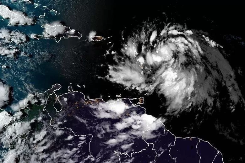
In its 5 p.m. update, the National Hurricane Center said Ernesto had become a tropical storm with maximum sustained winds of 40 mph.
In the 8 p.m. update, the winds remained at 40 mph.
Ernesto was about 230 miles east of Antigua and 530 miles east-southeast of San Juan, Puerto Rico, and was moving about 28 mph west-northwest.
NHC said the storm is expected to track quickly toward the Leeward Islands late Monday or Tuesday.
On the forecast track, Ernesto is expected to move over the U.S. and British Virgin Islands and Puerto Rico by Tuesday night. Then Ernesto is forecast to turn northward over the western Atlantic.
It is currently forecast to reach Category 1 hurricane strength at 2 a.m. Thursday and possibly impact Bermuda at 2 p.m. Saturday.
“It is too soon to know what impacts Ernesto could bring to Bermuda late this week, and interests there should monitor the progress of this system,” NHC Forecaster Steve Cangialosi said.
Tropical storm warnings are is in effect for St. Kitts, Nevis, Montserrat, Antigua, Barbuda, Anguilla; Guadeloupe, St. Martin and St. Barthelemy, British Virgin Islands, U.S. Virgin Islands, Puerto Rico, Vieques and Culebra.
Tropical-storm-force winds extend outward up to 60 miles from the center.
“Heavy rainfall may result in locally considerable flash flooding and mudslides in areas of the Leeward and Virgin Islands through Wednesday, and over Puerto Rico late Tuesday into Thursday,” Cangialosi said.
In Puerto Rico, 3 to 6 inches of rainfall with maximum amounts of 10 inches are expected.
Plans are underway in several Puerto Rican communities regarding the availability of supplies, backup services and flood mitigation.
“After the experience with Hurricane María, we have established that immediately there is a particular event there is a group of employees already duly assigned to throw themselves [into the streets[ and attend to the main roads,” Aibonito Mayor William Alicea told El Nuevo. “The problem is that people go crazy removing debris.”
Hurricane Maria in 2018 caused an estimated $90 billion in damage in Puerto Rico and the U.S. Virgin Islands, NHC said. Maria was the most destructive hurricane to hit Puerto Rico in modern times and the third costliest hurricane in U.S. history behind Katrina and Harvey.
Maria also knocked down 80% of Puerto Rico’s utility poles and all transmission lines, resulting in loss of power to essentially all of the island’s 3.4 million residents. Nearly all cellphone and municipal water supplies also were knocked out.
Ernesto Morales, a National Weather Service meteorologist and warnings coordinator, told The San Juan Daily Star, the atmospheric system could cause rains, floods, landslides and dangerous maritime conditions.
Debby was a Category 1 storm that made landfall in the Florida Panhandle and then moved through the U.S. Atlantic Coast last week.
Beryl struck parts of the Caribbean, the Yucatán Peninsula and the Gulf Coast of the United States in late June and early July.
Two tropical storms were in the Gulf of Mexico in June: Cindy and Alberto.