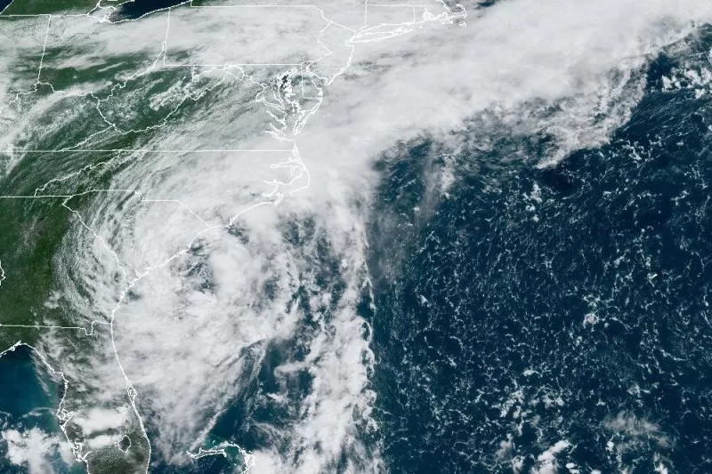
Tropical Storm Debby is forecast to make another landfall Thursday in South Carolina. Image courtesy of NOAA
Aug. 6 (UPI) — Tropical Storm Debby slowed slightly Wednesday afternoon as it moved north-northeast near the U.S. coast with forecasters warning that it will return inland over South Carolina on Thursday.
The storm had maximum sustained winds of 60 mph and was located about 50 miles east-southeast of Charleston, S.C., and 85 miles south of Myrtle Beach, S.C., the National Hurricane Center said in its 5 p.m. EDT update Wednesday.
It was moving north-northeast at 3 mph after traveling at 5 mph Wednesday morning.
“A turn toward the north is expected tonight, bringing the center across the South Carolina coast on Thursday morning,” the National Oceanic and Atmospheric Administration announced Wednesday afternoon.
“After landfall, a faster motion toward the north and north-northeast across the Carolinas and the U.S. Mid-Atlantic states is expected on Thursday and Friday,” the NOAA said.
The combination of storm surge and tide will cause normally dry areas near the coast to flood with rising waters moving inland from the shoreline, the NOAA reported.
The water could cause between 1 foot and 3 feet of flooding from the South Santee River to Ocracoke Inlet, including the Neuse and Pamlico rivers, in South Carolina.
A tropical storm warning is in effect of north of the Savannah River to Surf City, N.C., while a tropical storm watch is in effect of north of Surf City to Beaufort Inlet, N.C.
Earlier, forecasters said Debby was expected to produce potentially “historic” rainfall totals of 10 to 20 inches, with maximum amounts of 20 inches, threatening “catastrophic flooding” across portions of eastern Georgia, the coastal plain of South Carolina and southeast North Carolina through Wednesday.
“This is a life-threatening situation,” NHC said. “Persons located within these areas should take all necessary actions to protect life and property from rising water and the potential for other dangerous conditions. Promptly follow evacuation and other instructions from local officials.”

