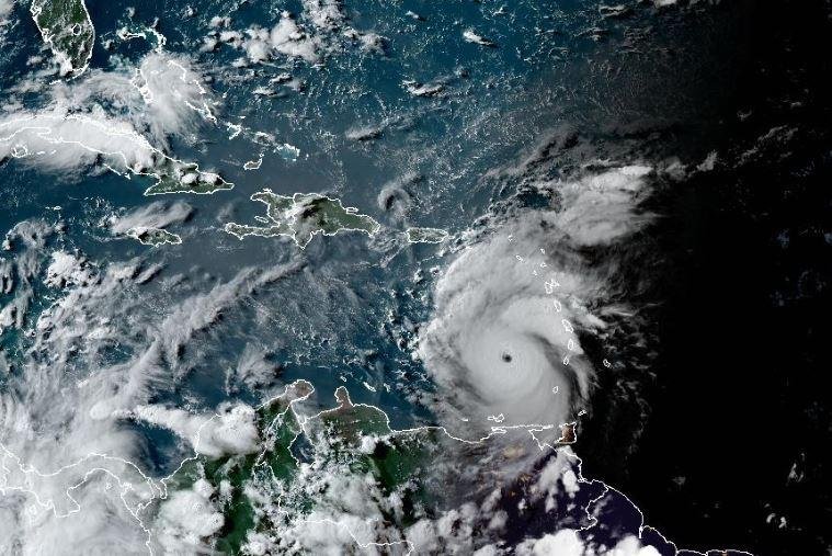
Hurricane Beryl, a Category 4 storm, churns through the Atlantic Ocean with wind speeds reaching 130 mph. Photo courtesy NOAA
July 1 (UPI) — Hurricane Beryl was continuing to batter the southern Windward Islands with tropical storm conditions Monday night after making landfall in Grenada as a powerful Category 4 storm.
In its 5 p.m. EDT update, the National Hurricane Center said Beryl remains a Category 4 hurricane with sustained winds still at 150 mph and moving west-northwest at 21 mph. Beryl was about 125 miles northwest of Grenada, carrying maximum sustained winds of 150 mph and moving west-northwest at 21 mph.
“Major hurricane Beryl moving over the southeastern Caribbean,” the NHC said. “Tropical storm conditions, dangerous waves and heavy rainfall persist over the southern Windward Islands.”
The southen Windward Islands include Grenada, St. Vincent and the Grenadine Islands and Martinique.
Water levels should recede into night over the southern Windward Islands, the NHC said.
Beryl could raise water levels by as much as 2 to 4 feet above normal tide levels in areas of onshore winds along the immediate coast of Jamaica. In an earlier update, the surge was forecast at 9 feet.
On the forecast track, the center of Beryl will move across open waters in the the southeastern and central Caribbean Sea from Monday night through through Tuesday. Beryl is forecast to pass near Jamaica on Wednesday.
“Fluctuations in strength are likely during the next day or so, but Beryl is expected to remain an extremely dangerous major hurricane as its core moves through the Windward Islands into the eastern Caribbean,” the NHC said.
“Some weakening is expected in the central Caribbean by midweek, though Beryl is forecast to remain a hurricane.”
The center said that hurricane-force winds extended outward up to 40 miles from the center of the eye with tropical-storm-force winds extending up to 125 miles.
Beryl had slightly weakened to a Category 3 storm early Monday with winds of 120 mph, before strengthening again to a Category 4.
A hurricane watch was in effect for Jamaica. The hurricane warning for Barbados was discontinued.
And the hurricane warning for St. Vincent and the Grenadines dropped to a tropical storm warning in the 5 p.m. update.
A tropical storm warning also is in effect for Martinique, St. Lucia, and a tropical storm watch was in effect for the south coast of the Dominican Republic from Punta Palenque westward to the border with Haiti and the south coast of Haiti from the border with the Dominican Republic to Anse d’Hainault.
The United States is not expected to be affected by the storm. Beryl is about 1,500 miles from Florida.
Beryl made landfall on Grenada’s Carriacou Island in the Caribbean Sea with maximum sustained winds of 150 mph around 11 a.m. It is the strongest known hurricane to pass through the Grenadines, according to data from NOAA since 1851.
The storm triggered power outages, flooded streets and storm surge flooding for parts of the Grenadines, Grenada, Barbados and Tobago on Monday, according to the National Hurricane Center.
Beryl is the earliest Category 4 hurricane on record in the Atlantic and the only Category 4 storm ever recorded in June.
Only seven named storms have formed over the last 173 years in this sector of the Atlantic before July 4, according to Accuweather.
Alberto, the first tropical storm of the season, made landfall over Mexico on June 20 and then pummeled Texas the next day with rain.
Tropical Storm Chis, the third named storm of the season, made landfall in eastern Mexico late Sunday.

