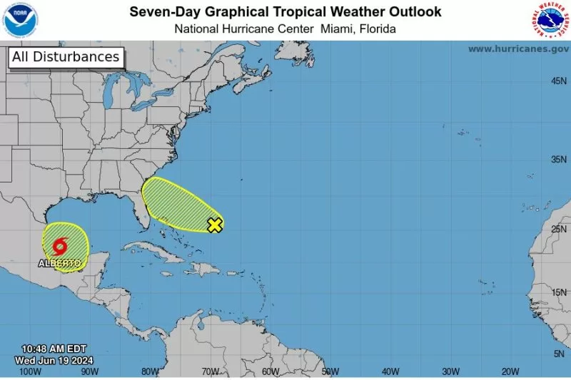
The first named storm of the Atlantic hurricane season has now formed over the Gulf of Mexico, the National Oceanic and Atmospheric Administration confirmed on Wednesday. Image courtesy of the National Hurricane Center
June 19 (UPI) — The first named storm of the Atlantic hurricane season has now formed over the Gulf of Mexico, the National Oceanic and Atmospheric Administration confirmed on Wednesday.
Tropical Storm Alberto was moving west at 8 nautical miles an hour, with winds gusting up to 51 mph, according to the most recent update issued by the National Weather Service at 11:07 a.m. EDT.
The first bands of rain associated with Alberto began hitting the coastal United States early Wednesday morning, according to the NWS.
Forecasters warned motorists the storm could start affecting the I-35 corridor as early as Wednesday afternoon.
The storm is expected to move farther inland early Thursday morning, bringing up to 15 inches of rain to parts of Texas and Louisiana, in what forecasters are calling a “very active” 2024 hurricane season. Alberto is also expected to affect parts of northeastern Mexico, where officials have warned of potential mudslides around the cities of Monterrey and Ciudad Victoria.
The National Hurricane Center has issued multiple tropical storm warnings across the Texas coast from San Luis Pass near Galveston to the mouth of the Rio Grande River. Authorities are cautioning the storm surge from Alberto could reach as high as 4 feet.
The Texas cities of Galveston and Surfside Beach were already seeing flooding as of 12 p.m. EDT Wednesday. The heaviest rain in that state is predicted to fall in south Corpus Christi.
“Extensive coastal flooding has been reported at area beaches, coastlines. No changes to existing warnings,” the NWS Houston office said in its latest update.
Alberto is not the only storm system currently moving towards the United States.
The National Hurricane Centre and Central Pacific Hurricane Centre are tracking a storm currently located several hundred miles east of the Bahamas.
“Environmental conditions are marginally conducive for some gradual development of this system during the next few days while it moves westward or west-northwestward,” the center said in its latest update.
“The system is forecast to approach the coast of the southeastern United States by the latter part of this week.”

