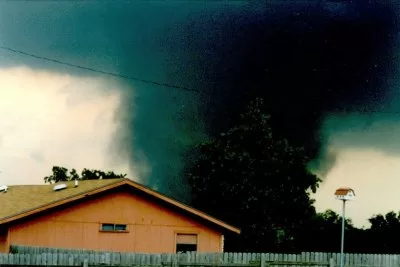
April 26 (UPI) — Tornadoes ripped through eastern Nebraska and northern Texas Friday, and weather officials said more is coming this weekend for the Plains region.
The National Weather Service in Omaha/Valley early Friday afternoon issued a tornado watch until 7 p.m. for all of central and eastern Nebraska including Omaha, Lincoln and Grand Island.
In just a few hours, tornado warnings extended to nearly 50,000 people in the eastern half of the state.
One tornado churning through Lincoln flipped a semi-trailer onto I-80 northeast of the city, slowing traffic to a crawl.
By around 4:30 p.m. CDT, first responders reported major damage, with several houses destroyed and multiple people trapped in their basements outside of Omaha and in Washington County.
Several tornados hit the Omaha metro area at about 5:15 p.m. CDT.
Eppley Airfield shut down after a tornado damaged the east side of the airfield where the general aviation area is, according to Omaha Airport Authority Chief Information Officer Steve McCoy.
“We’re still doing damage assessment,” McCoy said. “The terminal is relatively unaffected. But the airport is closed while we do damage assessment. We hope to reopen soon.”
Tornado warnings for many areas of Nebraska and Iowa were set to lift by 6 p.m CDT.
Flash flood warnings also are in effect for Omaha and Bellevue until 8 p.m.
At least two tornadoes touched down in Texas Friday afternoon after severe thunderstorms that morning.
Video of the cyclone posted to X showed it cutting through a large field east of Waco.
The National Weather Service Fort Worth/Dallas issued tornado warnings for Canton, Grand Saline and Van until 5:15 p.m. CDT. A severe thunderstorm warning was in effect for Kaufman, Canton and Wills Point until 5:30 pm.
Several cities, including, Dallas; Omaha; Kansas City, Mo.; and Des Moines, Iowa, can expect multiple rounds of severe thunderstorms through Sunday.
The quickly developing storms prompted the Storm Prediction Center to expand a Level 3 of 5 risk in Nebraska, Iowa, Kansas and Missouri to include Oklahoma, Arkansas and Texas by Friday afternoon.
Saturday could be even more dangerous depending on how Friday night’s storms shape up. More than 55 million Americans from Texas to Michigan could feel their effects, including Austin, Dallas, Oklahoma City, Kansas City, Chicago and Milwaukee.
“A complex but potentially significant severe weather episode is expected on Saturday,” the the Storm Prediction Center said Friday.
A Level 3 of 4 risk of excessive rainfall is in place for Oklahoma City and Tulsa, as well as parts of Texas and Kansas.
Heavy rainfall and flooding is possible on Sunday, especially in the Lower Mississippi Valley.
Springtime often means tornado season for the Plains and parts of the Midwest, as moist air from the Gulf of Mexico flows into the central United States and heats up the region, priming the atmosphere for severe storms.
