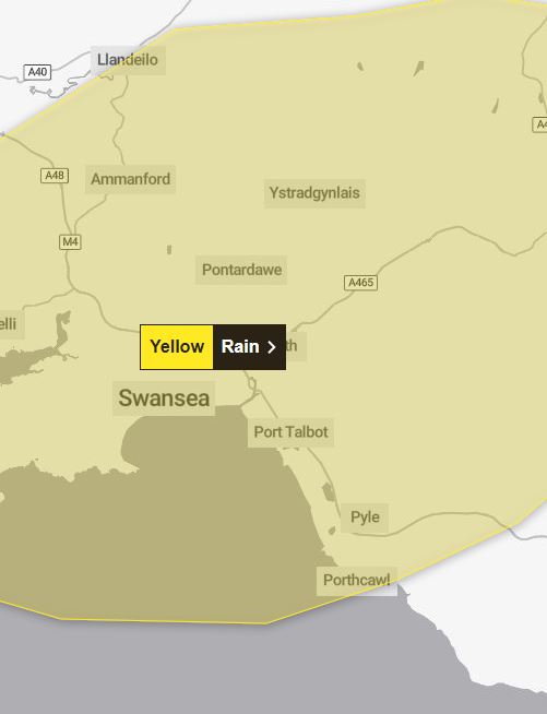
The warning covers Swansea in South Wales, stretching towards Cardiff in the east and nudging towards Carmarthen in the west.
It is in place from 9pm on Saturday until 6am on Sunday.
There is expected to be some surface water flooding and transport disruption overnight and into early Sunday morning.
Flooding of some homes and businesses is possible and flooding on road could make journey times longer.
Eastern areas will also see a wet start to Sunday with rain slow to clear, the Met Office predicts.
Elsewhere it will be drier with some sunny spells and the odd shower.
It will be drier and brighter in Northern Ireland and northern Scotland with sunny spells.
It will remain mild and feel pleasant in the sunshine.
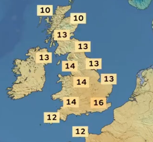
Sunday will be a mild day, with above average temperatures.
Looking ahead to the early part of the working week, it will be mostly dry but the rain will soon come in from the west.
Conditions will be changeable with temperatures around average for the time of year.
Figures are also expected to reach a high of 16C in the south east.
Going into next week, more rain is set to arrive from the west and temperature are due to be “changeable”.
The Met Office’s long range forecast
March 21 to March 30
Dry for most places at first on Thursday, but rain will quickly spread from the north west across all areas.
The heaviest and most persistent rain will be in the northwest, with relatively little rain reaching the southeast.
Strong winds are also expected, particularly along coasts.
Through Friday and the weekend, northwesterly winds will bring a mixture of sunny spells and showers, some of these heavy.
A drier spell may develop later in the weekend with temperatures likely to be below normal for many areas.
Into the following week, more unsettled conditions will probably develop across parts of the UK, these most likely to affect southern areas.
Northern areas are more likely to be dry but also colder.


