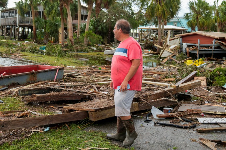
The storm descended on South and North Carolina on its way out to the Atlantic Ocean on Thursday, a day after making landfall on the Gulf Coast of Florida.
Idalia crashed ashore on Wednesday morning as a powerful Category 3 hurricane at Keaton Beach in Florida’s northern Big Bend region, lashing the coast with sustained winds of up to 201 kilometres per hour (125 miles per hour) and torrential rains.
At one point, the storm left as many as 500,000 customers without power in Florida and other US states as it ripped down electricity poles and lines.
But Idalia was less catastrophic than feared, with property damage, loss of life and power disruptions paling in comparison to the last major hurricane that struck Florida nearly a year ago, Hurricane Ian.
The White House on Thursday approved an emergency declaration for South Carolina, allowing federal government assistance to flow to the state.
The storm coupled with king tides to send seawater flowing over sand dunes and spilling onto beachfront streets.
In Charleston, South Carolina, a surge from Idalia topped the seawall that protects the downtown, sending ankle-deep ocean water into the streets and neighbourhoods where horse-drawn carriages pass million-dollar homes and a famous open-air market.
Preliminary data showed the Wednesday evening high tide reached just greater than 2.8 metres (9.2 feet), more than 0.9 metres (three feet) above normal and the fifth-highest reading in Charleston Harbor since records were first kept in 1899.
Bands from Idalia also brought short-lived tornadoes. One flipped a car in suburban Goose Creek, South Carolina, causing minor injuries, authorities said. No major damage was reported.
In North Carolina, Governor Roy Cooper, who declared a statewide emergency earlier this week as Idalia approached, had warned residents in coastal and eastern inland counties to prepare for heavy rainfall and localised flooding and urged them to stay off roads covered by water.
“We have got at least 312,000 people from Florida, Georgia through the Carolinas without power,” NBC News correspondent Wendy Woolfolk told Al Jazeera from Charleston on Thursday morning.
“There is a still a tropical storm warning for the entire coast of North Carolina and that means they are experiencing those terrible winds and those driving rains and the treacherous storm surge,” she said.
“We are hoping and crossing our fingers though that the forecasters are correct and that Idalia will head back out to sea at some point this afternoon.”

The head of the Federal Emergency Management Agency, Deanne Criswell, will be in Florida on Thursday to assess the damage alongside Governor Ron DeSantis.
Speaking to reporters from the White House on Wednesday afternoon, Criswell said the country has seen an increase in severe weather events, including storms that intensify more rapidly due to warmer water temperatures.
“These storms are intensifying so fast that our local emergency management officials have less time to warn and evacuate and get people to safety,” she said.
“This is something that we have to take into consideration as we build our preparedness plans, as our local communities build their preparedness plans and how they’re going to communicate and prepare their communities for the types of storms that they’re going to face in the future.”
Still, Idalia appeared to be far less destructive than first feared.
Its path took it away from the large urban regions of Florida, striking only glancing blows to Tampa Bay and other more populated areas while the fury of the storm was focused on the rural Big Bend section. Damage there was likely to be extensive.
At Horseshoe Beach in central Big Bend, Jewell Baggett picked through the wreckage and debris of her mother’s destroyed home, finding a few pictures and her mother’s pots and pans.
Her grandfather built the home decades ago and it had survived four previous storms, she said.
“And now it’s gone,” she said. “Nothing left. A few little trinkets here and there.”
Idalia is expected to drift along the South Carolina coast through much of Thursday before curling eastward off North Carolina and out into the Atlantic on Thursday night, the National Hurricane Center said.
